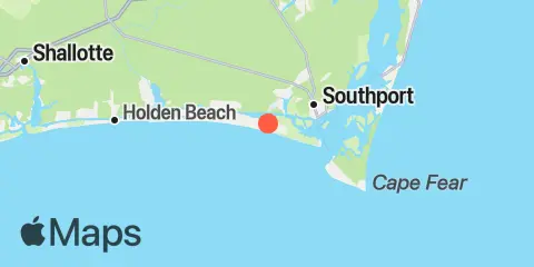
Oak Island Map
Latitude
33° 54' 6" N (33.9017)
Longitude
78° 4' 54" W (-78.0817)
State
County
Nearest ZIP
28465
Nearby
Tides
3.7 mi
Fort Caswell, Cape Fear River
3.8 mi
Southport, Cape Fear River
4.8 mi
Bald Head, Cape Fear River
7.5 mi
Cape Fear
8.2 mi
Varnamtown, Lockwoods Folly River
8.2 mi
Zekes Island, Cape Fear River
8.8 mi
Lockwoods Folly Inlet
9.1 mi
Federal Point, Cape Fear River
9.4 mi
Sunny Point Army Base, Wharf no.1, Cape Fear River
10.1 mi
Reaves Point, Cape Fear River
11.4 mi
Wharf 3, MOTSU, Cape Fear River
Currents
1.5 mi
Oak Island Bridge, ICW
2.5 mi
Southport at Dutchman Creek, ICW
4.1 mi
Southport
4.4 mi
Fort Caswell
4.5 mi
Bald Head Shoal
6.4 mi
Snows Marsh Channel
9.2 mi
Sunny Point, 0.5 nm SE of
10.1 mi
Reaves Point, 0.3 mile east of
10.3 mi
Reaves Point, 0.4 mile north of
10.4 mi
Reaves Point Channel
10.9 mi
Reaves Point, 0.9 NM NE of
12.0 mi
Upper Midnight Channel