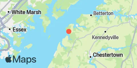
Latitude
39° 17' 48" N (39.2967)
Longitude
76° 10' 18" W (-76.1717)
State
County
Nearest ZIP
21678
Nearby
Tides
7.0 mi
Tolchester Beach, Chesapeake Bay
7.7 mi
Pond Point (Aberdeen P.G.), Bush River, Chesapeake Bay
7.8 mi
Sassafras River, Betterton, Chesapeake Bay
8.5 mi
Chestertown, Chester River
11.5 mi
Deep Landing, Swan Creek, Chesapeake Bay
Currents
2.6 mi
Worton Point, 1.5 n.mi. WSW of
2.9 mi
Worton Point, 1.1 miles northwest of
3.3 mi
Pooles Island, 1.6 n.mi. east of
5.2 mi
Robins Point, 0.7 mile ESE of
5.6 mi
Howell Point, 0.8 n.mi. west of
6.0 mi
Pooles Island, 0.8 mile south of
6.2 mi
Bush River, 0.4 mi. SW of Bush Point
6.3 mi
Howell Point, 0.4 mile NNW of
6.9 mi
Tolchester Beach, 0.33 n.mi. west of
7.4 mi
Gunpowder River entrance
7.5 mi
Pooles Island 2.0 n.mi. SSW of
8.6 mi
Chestertown
8.7 mi
Miller Island, 1.5 miles ENE of
8.9 mi
Tolchester Channel, Buoy '22'
8.9 mi
Grove Point
9.5 mi
Grove Point, 0.7 n.mi.NW of
9.5 mi
Tolchester Channel, south of Buoy '38B'
9.8 mi
Pooles Island, 4 miles southwest of
9.8 mi
Tolchester Channel, SW of Bouy '58B'
11.2 mi
Ordinary Point, 0.4 mile west of
11.7 mi
Swan Point, 1.6 miles northwest of
