TidesPro
  • Recents
    • Tolchester Beach, Chesapeake Bay
  • Tides
    United States
    Alabama Alaska California Connecticut Delaware District of Columbia Florida Georgia Hawaii
    Louisiana Maine Maryland Massachusetts Mississippi New Hampshire New Jersey New York North Carolina
    Oregon Pennsylvania Rhode Island South Carolina Texas US Outlying Islands Virginia Washington Puerto Rico
    Caribbean
    The Bahamas Cayman Islands Cuba Dominican Republic Haiti Jamaica Virgin Islands (US)
  • Fishing  Coordinates
    Alabama - Alabama Inshore Public Reefs Alabama - Alabama Nearshore Public Reefs Alabama - Alabama Offshore Public Reefs California - California Artificial Reefs Delaware - Delaware Artificial Reefs Florida - Bay County Florida - Brevard County Florida - Broward County Florida - Charlote and Lee Counties Florida - Citrus County Florida - Collier County Florida - Dixie County Florida - Duval County Florida - Escambia County Florida - Flagler County Florida - Florida Keys Florida - Franklin County Florida - Gulf County Florida - Hernando County
    Florida - Indian River County Florida - Levy County Florida - Manatee County Florida - Martin County Florida - Miami-Dade County Florida - Monroe County Florida - Nassau County Florida - Okaloosa County Florida - Palm Beach County Florida - Pasco County Florida - Santa Rosa County Florida - Sarasota County Florida - St. Johns County Florida - St. Lucie County Florida - Tampa Bay Florida - Taylor County Florida - Volusia County Florida - Wakulla County Florida - Walton County
    Georgia - Georgia Reefs Hawaii - Hawaii Artificial Reefs Louisiana - Louisiana Artificial Reefs Maryland - Maryland Artificial Reefs Massachusetts - Massachusetts Artificial Reefs Mississippi - Mississippi Inshore Artificial Reefs Mississippi - Mississippi Offshore Artificial Reefs New Jersey - New Jersey Artificial Reefs New York - New York Artificial Reefs North Carolina - Estuarine North Carolina - Long Bay North Carolina - Onslow Bay North Carolina - Outer Banks North Carolina - Raleigh Bay Puerto Rico - Puerto Rico Artificial Reefs Rhode Island - Rhode Island Artificial Reefs South Carolina - South Carolina Reefs Texas - Texas Artificial Reefs Virginia - Virginia Artificial Reefs
  • Solunar Tables
Tolchester Beach Location
  1. United States
  2. Maryland
  3. Tolchester Beach, Chesapeake Bay

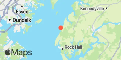
Tolchester Beach Map

Day Week Month Table Month Chart Map
Latitude
39° 12' 48" N (39.21344)
Longitude
76° 14' 40" W (-76.24453)
State
Maryland
County
Kent County
Nearest ZIP
21620
Nearby
Tides 4.8 mi Deep Landing, Swan Creek, Chesapeake Bay 7.0 mi Worton Creek entrance, Chesapeake Bay 9.1 mi Cliffs Wharf, Chester River 9.2 mi Cliffs Point, Chester River 9.7 mi Chestertown, Chester River 10.8 mi North Point, Patapsco River 12.1 mi Pond Point (Aberdeen P.G.), Bush River, Chesapeake Bay Currents 0.3 mi Tolchester Beach, 0.33 n.mi. west of 1.9 mi Tolchester Channel, Buoy '22' 2.7 mi Tolchester Channel, south of Buoy '38B' 2.9 mi Tolchester Channel, SW of Bouy '58B' 3.6 mi Pooles Island 2.0 n.mi. SSW of 3.7 mi Pooles Island, 0.8 mile south of 4.3 mi Pooles Island, 1.6 n.mi. east of 4.7 mi Pooles Island, 4 miles southwest of 4.8 mi Swan Point, 1.6 miles northwest of 5.8 mi Robins Point, 0.7 mile ESE of 6.3 mi Miller Island, 1.5 miles ENE of 6.8 mi Swan Point, 2.6 n.mi. west of 6.9 mi Worton Point, 1.5 n.mi. WSW of 7.6 mi Gunpowder River entrance 8.0 mi Swan Point, 2.7 n.mi. SW of 8.1 mi North Point, 2.5 miles northeast of 8.5 mi Worton Point, 1.1 miles northwest of 8.5 mi Brewerton Channel Eastern Ext., Buoy '7' 9.7 mi Craighill Angle, right outside quarter 9.8 mi Chestertown 9.9 mi Bush River, 0.4 mi. SW of Bush Point 9.9 mi Love Point, 2.5 miles north of 10.0 mi Deep Point 10.1 mi Love Point, 2.0 nmi north of 10.7 mi Lynch Point, Back River 11.4 mi Craighill Channel, Belvidere Shoal 12.2 mi Craighill Channel, NE of Mountain Pt

About

TidesPro was created as an easy-to-use tides and solunar site. It provides tide predictions and marine weather for many types of people, whether you’re fishing, going to the beach, boating, kayaking, surfing, or planning a trip. With anglers in mind, it also provides an accessible way to find fishing spots and the best times to fish in those locations.

More About TidesPro

App

Apple App Store
[More Info]
Quick Links
  • When to Fish
  • Solunar Theory
  • Tide & Solunar Widgets for Your Site
  • Tide & Solunar Predictions in Google Earth
  • Things to Do
  • About

© Copyright 2017 - 2025 ASR Concepts LLC. All rights reserved.

  • Privacy Policy
  • •
  • Terms of Use
  • •
  • Contact
  • •
  • Bluesky
  • •
  • Mastodon