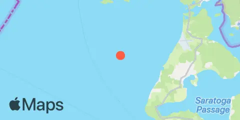
Latitude
48° 19' 0" N (48.3167)
Longitude
122° 50' 13" W (-122.837)
State
County
Nearest ZIP
98277
Nearby
Tides
5.5 mi
Sunset Beach, Whidbey Island, Strait of Juan de Fuca
6.7 mi
Point Partridge, Whidbey Island, Strait of Juan de Fuca
7.2 mi
Naval Air Station Whidbey Island
7.5 mi
Aleck Bay, Lopez Island
8.9 mi
Telegraph Bay
9.4 mi
Coupeville, Penn Cove, Whidbey Island
9.4 mi
Richardson, Lopez Island, San Juan Channel
10.3 mi
Crescent Harbor, N. Whidbey Island
10.9 mi
Deception Pass St. Park, Bowman Bay, Fidalgo I.
11.5 mi
Cornet Bay, Deception Pass
11.9 mi
Burrows Bay (Allan Island)
12.2 mi
Yokeko Point, Deception Pass
Currents
1.3 mi
Smith Island, 1.4 miles SSW of
3.1 mi
Smith Island, 3.4 mi. ESE of
5.8 mi
Colville Island, 1 mile SSE of
5.9 mi
Iceberg Point, 2.1 miles SSW of
5.9 mi
Smith Island, 5.5 mi. WNW of
5.9 mi
Point Partridge, 3.7 miles west of
7.5 mi
Point Colville, 1.4 nm east of
8.0 mi
Point Colville, 3.0 nm east of (Lawson Reef, 1 nm
9.4 mi
Cattle Point, 4.6 nm SW of
9.4 mi
Cattle Point, 2.8 miles SSW of
9.6 mi
Cattle Point, 1.2 nm SE of
10.4 mi
New Dungeness Light, 6 miles NNE of
10.6 mi
Rosario Strait
10.8 mi
Deception Pass (Narrows)
11.3 mi
San Juan Channel, south entrance
11.3 mi
Lopez Pass
11.9 mi
Point Wilson, 2.7 mi. NE of
12.2 mi
Point Wilson, 1.6 mi. NE of
12.2 mi
Yokeko Point, Deception Pass
12.3 mi
Point Wilson, 0.6 mi. NE of
12.3 mi
Violet Point, 3.7 mi. NW of Protection Island
12.3 mi
Burrows Bay, 0.5 mile east of Allan I
