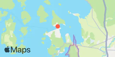
Anacortes Map
Latitude
48° 31' 6" N (48.5183)
Longitude
122° 37' 12" W (-122.62)
State
County
Nearest ZIP
98221
Nearby
Tides
2.7 mi
Ship Harbor, Fidalgo Island
5.3 mi
Burrows Bay (Allan Island)
5.7 mi
Strawberry Bay, Cypress Island
5.9 mi
Turner Bay, Similk Bay
6.4 mi
Swinomish Channel entrance, Padilla Bay
7.3 mi
Yokeko Point, Deception Pass
7.3 mi
Deception Pass St. Park, Bowman Bay, Fidalgo I.
7.5 mi
Tide Point, Cypress Island
8.1 mi
Cornet Bay, Deception Pass
8.2 mi
Armitage Island, Thatcher Pass
8.5 mi
Ala Spit, Whidbey Island
8.8 mi
Sneeoosh Point
9.9 mi
Telegraph Bay
10.0 mi
Peavine Pass
10.4 mi
La Conner, Swinomish Channel
Currents
0.9 mi
Guemes Channel, East Entrance
1.5 mi
Guemes Channel, West Entrance
2.8 mi
Saddle Bag Island Passage
3.1 mi
Huckleberry Island, 0.5 mile north of
3.3 mi
Bellingham Channel South
3.4 mi
Bellingham Channel, off Cypress Head Light
3.6 mi
Burrows Pass
4.1 mi
Green Point, 0.8 mile northwest of
4.8 mi
Burrows Bay, 0.5 mile east of Allan I
4.9 mi
Allan Pass
5.3 mi
Belle Rock Light, east of
5.4 mi
Bellingham Channel North Entrance
6.8 mi
Strawberry Island, west of
6.9 mi
Fauntleroy Point Light, east of
7.3 mi
Rosario Strait
7.3 mi
Yokeko Point, Deception Pass
7.5 mi
Towhead Island, 0.4 mile east of
7.8 mi
Deception Pass (Narrows)
8.4 mi
Thatcher Pass
8.5 mi
Skagit Bay channel, SW of Hope Island
8.9 mi
Sinclair Island, 1.0 nm NE of
9.2 mi
Point Colville, 3.0 nm east of (Lawson Reef, 1 nm
9.3 mi
Peapod Rocks Light, 1.2 nm south of
9.5 mi
Lopez Pass
9.8 mi
Frost-Willow Island, between
10.1 mi
Point Colville, 1.4 nm east of
10.3 mi
Peavine Pass, west entrance
10.6 mi
Obstruction Pass, north of Obstruction Island
12.0 mi
Lawrence Point, Orcas Island, 1.3 nm NE of
12.2 mi
Colville Island, 1 mile SSE of