Cape Charles Harbor (USCG Wharf) Weekly Tide Tables and Charts
Tide Chart for Next 7 Days
Cape Charles Harbor (USCG Wharf) weekly tide chart key:
The tide chart above shows the times and heights of high tide and low tide for Cape Charles Harbor (USCG Wharf), for the next seven days. The red line highlights the current time and estimated height.The tidal range at Cape Charles Harbor (USCG Wharf) for the next seven days is approximately 3.56 ft with a minimum tide of -0.33 ft and maximum tide of 3.23 ft. You can also check out all the daily details on tides & fishing times on the Day tab for Cape Charles Harbor (USCG Wharf).
Tide Table for Next 7 Days
▲ Blue = High Tide
▼ Red = Low Tide
| Day | 1st Tide | 2nd Tide | 3rd Tide | 4th Tide | ☀ Sun |
Major Solunars
|
Minor Solunars
|
|
|---|---|---|---|---|---|---|---|---|
| 22 Tue |
|
▲ 2.27 ft |
▼ 0.42 ft |
▲ 2.13 ft |
▼ 0.33 ft |
▲ 6:20 AM ▼ 7:46 PM |
8:36 AM → 10:36 AM 8:55 PM → 10:55 PM |
3:26 AM → 4:26 AM 1:55 PM → 2:55 PM |
| 23 Wed |
|
▲ 2.35 ft |
▼ 0.27 ft |
▲ 2.35 ft |
▲ 6:19 AM ▼ 7:47 PM |
9:26 AM → 11:26 AM 9:44 PM → 11:44 PM |
3:56 AM → 4:56 AM 3:05 PM → 4:05 PM |
|
| 24 Thu |
|
▼ 0.15 ft |
▲ 2.44 ft |
▼ 0.1 ft |
▲ 2.62 ft |
▲ 6:17 AM ▼ 7:48 PM |
10:15 AM → 12:15 PM 10:34 PM → 12:34 AM |
4:24 AM → 5:24 AM 4:17 PM → 5:17 PM |
| 25 Fri |
|
▼ -0.03 ft |
▲ 2.52 ft |
▼ -0.06 ft |
▲ 2.87 ft |
▲ 6:16 AM ▼ 7:48 PM |
11:04 AM → 1:04 PM 11:24 PM → 1:24 AM |
4:51 AM → 5:51 AM 5:29 PM → 6:29 PM |
| 26 Sat |
|
▼ -0.19 ft |
▲ 2.56 ft |
▼ -0.19 ft |
▲ 3.08 ft |
▲ 6:15 AM ▼ 7:49 PM | 11:55 AM → 1:55 PM |
5:19 AM → 6:19 AM 6:44 PM → 7:44 PM |
| 27 Sun |
|
▼ -0.3 ft |
▲ 2.57 ft |
▼ -0.28 ft |
▲ 3.2 ft |
▲ 6:14 AM ▼ 7:50 PM |
12:16 AM → 2:16 AM 12:50 PM → 2:50 PM |
5:49 AM → 6:49 AM 8:02 PM → 9:02 PM |
| 28 Mon |
|
▼ -0.33 ft |
▲ 2.54 ft |
▼ -0.3 ft |
▲ 3.23 ft |
▲ 6:12 AM ▼ 7:51 PM |
1:15 AM → 3:15 AM 1:48 PM → 3:48 PM |
6:25 AM → 7:25 AM 9:26 PM → 10:26 PM |
Buoy Weather
Air Temperature
71.6° F
Water Temperature
61.7° F
Wind
4.1 knots N (360°)
Wind Gust
5.1 knots
Atmospheric Pressure
30.02 in
Note: Observations are from a weather buoy 7.02 miles from the prediction site. Observations are not available at all prediction sites, and observation types vary between sites.
More details: Station kptv2 Buoy Weather
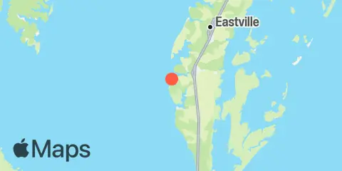
Location & Map
Latitude
37° 15' 48" N (37.2633)
Longitude
76° 1' 12" W (-76.02)
State
County
Nearest ZIP
23310
Nearby
Tides
2.7 mi
Old Plantation Light, Chesapeake Bay
5.5 mi
Oyster Harbor
7.0 mi
Kiptopeke Beach, Chesapeake Bay
11.4 mi
Smith Island (Coast Guard Station)
11.7 mi
Fishermans Island, Chesapeake Bay
Currents
3.4 mi
Old Plantation Flats Lt., 0.5 mi. W of
4.1 mi
Cape Charles City, 3.3 n.mi. west of
7.4 mi
Butler Bluff, 2.1 n.mi. WSW of
7.5 mi
York Spit Channel, N of Buoy '26'
8.9 mi
Wolf Trap Light, 5.8 miles east of
9.6 mi
New Point Comfort, 4.1 n.mi. ESE of
9.7 mi
Church Neck Point, 1.9 n.mi. W of
10.3 mi
Wolf Trap Light, 6.1 n.mi. ENE of
10.6 mi
York River Entrance Channel (SE end)
10.6 mi
Wolf Trap Light, 5.2 n.mi. ENE of
10.6 mi
Cape Charles, off Wise Point
10.8 mi
Fishermans I., 1.1 miles northwest of
11.2 mi
Fishermans I., 1.4 n.mi. WNW of
11.9 mi
Fishermans I., 0.4 mile west of
Note: Tide predictions are an estimate and NOT FOR NAVIGATION.
We also offer free widgets if you want to add tide or solunar tables to your own site.