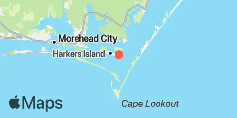
Shell Point Map
Latitude
34° 40' 60" N (34.68333)
Longitude
76° 31' 60" W (-76.53333)
State
County
Nearest ZIP
28531
Nearby
Tides
3.4 mi
Harkers Island Bridge
4.9 mi
Cape Lookout Bight
5.1 mi
Channel Marker Lt. 59
5.2 mi
Cape Lookout (Ocean)
5.2 mi
Lenoxville Point
6.6 mi
Beaufort, Taylor Creek
7.6 mi
Beaufort Inlet Channel Range
8.2 mi
Duke Marine Lab, Beaufort
8.3 mi
Gallant Channel
8.5 mi
Fort Macon, USCG Station
8.6 mi
North River Bridge
9.0 mi
Davis, Core Sound
9.5 mi
Morehead City
9.8 mi
Newport River (Yacht Club)
10.2 mi
Triple S Pier, Atlantic Beach
10.4 mi
Morehead City Harbor
11.8 mi
Atlantic Beach Bridge
Currents
4.6 mi
Middle Marshes, S of
5.0 mi
Carrot Island
6.8 mi
Shackleford Point, NE of
7.0 mi
Bird Shoal, SE of
7.0 mi
Shackleford Banks, 0.8 mile S of
7.7 mi
Fort Macon, 0.6 mile SE of
7.8 mi
Beaufort Inlet Approach
8.2 mi
Fort Macon, 0.2 mile NE of
8.5 mi
Radio Island, E of
8.8 mi
Tombstone Point, 0.1 mile E of
9.2 mi
Newport Marshes, SE of
9.2 mi
Newport Marshes, E of
9.4 mi
Turning Basin
9.5 mi
Morehead City, RR. bridge, N of
10.5 mi
Sugarloaf Island, 0.2 mile S of
11.6 mi
Morehead City, S of