Lenoxville Point Weekly Tide Tables and Charts
Tide Chart for Next 7 Days
Lenoxville Point weekly tide chart key:
The tide chart above shows the times and heights of high tide and low tide for Lenoxville Point, for the next seven days. The red line highlights the current time and estimated height.The tidal range at Lenoxville Point for the next seven days is approximately 3.27 ft with a minimum tide of -0.56 ft and maximum tide of 2.71 ft. You can also check out all the daily details on tides & fishing times on the Day tab for Lenoxville Point.
Tide Table for Next 7 Days
▲ Blue = High Tide
▼ Red = Low Tide
| Day | 1st Tide | 2nd Tide | 3rd Tide | 4th Tide | ☀ Sun |
Major Solunars
|
Minor Solunars
|
|
|---|---|---|---|---|---|---|---|---|
| 2 Sun |
|
4:55 AM ▼ -0.47 ft |
11:13 AM ▲ 2.53 ft |
5:20 PM ▼ -0.56 ft |
11:46 PM ▲ 2.59 ft |
▲ 7:04 AM ▼ 5:37 PM |
3:25 AM → 5:25 AM 3:54 PM → 5:54 PM |
9:32 AM → 10:32 AM 10:28 PM → 11:28 PM |
| 3 Mon |
|
5:52 AM ▼ -0.3 ft |
12:02 PM ▲ 2.29 ft |
6:06 PM ▼ -0.5 ft |
▲ 7:03 AM ▼ 5:38 PM |
4:14 AM → 6:14 AM 4:43 PM → 6:43 PM |
10:01 AM → 11:01 AM 11:38 PM → 12:38 AM |
|
| 4 Tue |
|
12:42 AM ▲ 2.62 ft |
6:55 AM ▼ -0.11 ft |
12:55 PM ▲ 2.05 ft |
6:56 PM ▼ -0.4 ft |
▲ 7:02 AM ▼ 5:39 PM |
5:05 AM → 7:05 AM 5:34 PM → 7:34 PM |
10:33 AM → 11:33 AM |
| 5 Wed |
|
1:43 AM ▲ 2.62 ft |
8:04 AM ▼ 0.05 ft |
1:56 PM ▲ 1.83 ft |
7:54 PM ▼ -0.29 ft |
▲ 7:01 AM ▼ 5:40 PM |
5:58 AM → 7:58 AM 6:29 PM → 8:29 PM |
12:48 AM → 1:48 AM 11:09 AM → 12:09 PM |
| 6 Thu |
|
2:49 AM ▲ 2.61 ft |
9:18 AM ▼ 0.14 ft |
3:04 PM ▲ 1.69 ft |
8:58 PM ▼ -0.2 ft |
▲ 7:00 AM ▼ 5:41 PM |
6:56 AM → 8:56 AM 7:26 PM → 9:26 PM |
2:00 AM → 3:00 AM 11:52 AM → 12:52 PM |
| 7 Fri |
|
3:58 AM ▲ 2.62 ft |
10:31 AM ▼ 0.13 ft |
4:17 PM ▲ 1.65 ft |
10:06 PM ▼ -0.18 ft |
▲ 7:00 AM ▼ 5:42 PM |
7:56 AM → 9:56 AM 8:28 PM → 10:28 PM |
3:09 AM → 4:09 AM 12:43 PM → 1:43 PM |
| 8 Sat |
|
5:04 AM ▲ 2.66 ft |
11:36 AM ▼ 0.05 ft |
5:25 PM ▲ 1.7 ft |
11:12 PM ▼ -0.22 ft |
▲ 6:59 AM ▼ 5:43 PM |
8:58 AM → 10:58 AM 9:28 PM → 11:28 PM |
4:14 AM → 5:14 AM 1:42 PM → 2:42 PM |
Current Weather
Air Temperature
50.5° F
Water Temperature
50.2° F
Wind
8.9 knots NE (40°)
Wind Gust
13 knots
Atmospheric Pressure
30.28 in
Note: Observations are from a weather buoy 2.96 miles from the prediction site. Observations are not available at all prediction sites, and the number/type of observations varies between sites.
More details: Station bftn7 Buoy Weather
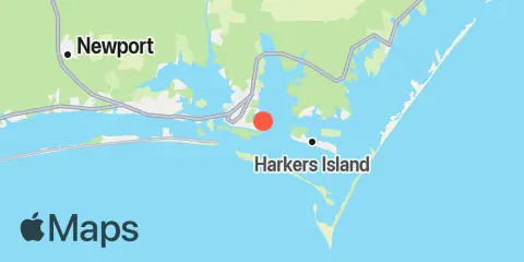
Location & Map
Latitude
34° 42' 30" N (34.7083)
Longitude
76° 37' 12" W (-76.62)
State
County
Nearest ZIP
28516
Nearby
Tides
0.3 mi
Channel Marker Lt. 59
1.4 mi
Beaufort, Taylor Creek
2.4 mi
Harkers Island Bridge
2.7 mi
Beaufort Inlet Channel Range
2.9 mi
Duke Marine Lab, Beaufort
3.1 mi
Gallant Channel
3.6 mi
Fort Macon, USCG Station
4.3 mi
Morehead City
5.1 mi
Newport River (Yacht Club)
5.2 mi
Shell Point, Harkers Island
5.2 mi
Morehead City Harbor
5.3 mi
Triple S Pier, Atlantic Beach
5.8 mi
North River Bridge
6.7 mi
Atlantic Beach Bridge
7.4 mi
N.C. State Fisheries
8.0 mi
Cape Lookout Bight
8.5 mi
Coral Bay, Atlantic Beach
8.7 mi
Cape Lookout (Ocean)
9.0 mi
Core Creek Bridge
10.5 mi
Spooner Creek
11.2 mi
Davis, Core Sound
Currents
0.4 mi
Carrot Island
2.0 mi
Bird Shoal, SE of
2.1 mi
Middle Marshes, S of
2.1 mi
Shackleford Point, NE of
3.2 mi
Fort Macon, 0.6 mile SE of
3.2 mi
Fort Macon, 0.2 mile NE of
3.4 mi
Radio Island, E of
3.5 mi
Shackleford Banks, 0.8 mile S of
3.8 mi
Tombstone Point, 0.1 mile E of
3.8 mi
Beaufort Inlet Approach
3.9 mi
Newport Marshes, SE of
4.0 mi
Newport Marshes, E of
4.2 mi
Turning Basin
4.3 mi
Morehead City, RR. bridge, N of
5.3 mi
Sugarloaf Island, 0.2 mile S of
6.4 mi
Morehead City, S of
Note: Tide predictions are an estimate and NOT FOR NAVIGATION.
We also offer free widgets if you want to add tide or solunar tables to your own site.