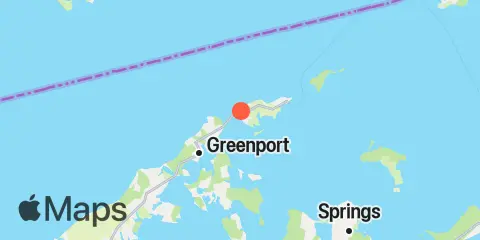
Latitude
41° 8' 12" N (41.1367)
Longitude
72° 18' 24" W (-72.3067)
State
County
Nearest ZIP
11957
Nearby
Tides
3.8 mi
Greenport, Shelter Island Sound
5.6 mi
Hashamomuck Beach, Long Island
5.8 mi
Plum Gut Harbor, Plum Island, Long Island
7.7 mi
Southold, Shelter Island Sound
9.0 mi
Saybrook Jetty, Connecticut River
9.2 mi
Sag Harbor, Shelter Island Sound
9.3 mi
Threemile Harbor entrance, Gardiners Bay, Long Island
9.9 mi
Noyack Bay, Shelter Island Sound
10.4 mi
Saybrook Point, Connecticut River
11.7 mi
Little Gull Island, Long Island
Currents
2.2 mi
Long Beach Pt., 0.7 mile southwest of
2.7 mi
Rocky Point, 0.3 mile north of
3.5 mi
Orient Point, 1 mile WNW of
3.6 mi
Ram Island, 1.4 miles NNE of
4.4 mi
Mulford Point, 3.1 miles northwest of
4.9 mi
Cornfield Point, 4 miles south of, Buoy CF
5.4 mi
Orient Point, 2.4 miles SSE of
5.4 mi
Plum Gut
5.7 mi
Ram Island, 2.2 miles east of
5.8 mi
Jennings Point, 0.2 mile NNW of
6.6 mi
North Haven Peninsula, north of
6.8 mi
Cornfield Point, 2.8 n.mi. SE of
7.0 mi
Cedar Point, 0.2 mile west of
7.1 mi
Plum Island, 0.8 mile NNW of
7.1 mi
Paradise Point, 0.4 mile east of
7.6 mi
Saybrook Breakwater, 1.5 miles SE of
7.8 mi
Gardiners Point & Plum Island, between
8.0 mi
Six Mile Reef, 2 miles east of
8.1 mi
Horton Point, 1.4 miles NNW of
8.4 mi
Gardiners Pt. Ruins, 1.1 miles N of
8.5 mi
Black Point and Plum Island, between
8.6 mi
Saybrook Breakwater Light
8.6 mi
Cornfield Point, 1.1 miles south of
8.6 mi
Little Peconic Bay entrance
8.7 mi
Hatchett Point, 1.6 n.mi. S of
8.9 mi
Hog Creek Point, north of
9.0 mi
Plum Island, 3nm. North of, Buoy PI
9.4 mi
Cornfield Point, 1.9 n.mi. SW of
9.5 mi
Hatchett Point, 1.1 miles WSW of
9.5 mi
Six Mile Reef, 2 miles south of, Buoy TE
9.9 mi
Great Gull Island, SW of
10.3 mi
Six mile Reef, 1 mile south of
10.4 mi
Saybrook Channel
10.4 mi
Six Mile Reef, 1.5 miles north of
10.7 mi
Kelsey Point, 2.1 miles southeast of
10.7 mi
Black Point, 0.8 mile south of
11.4 mi
Little Gull Island, 0.8 mile NNW of
12.1 mi
Kelsey Point, 1 mile south of
