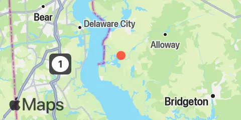
Latitude
39° 30' 18" N (39.505)
Longitude
75° 28' 60" W (-75.4833)
State
County
Nearest ZIP
08069
Nearby
Tides
0.7 mi
Abbots Meadow, Alloway Creek
1.9 mi
0.8 n.mi. above entrance, Alloway Creek
2.0 mi
Coopers Creek bridge, Alloway Creek
3.3 mi
Hope Creek, 0.6 n.mi. above entrance, Delaware River
4.0 mi
Artificial Island, Salem Nuclear Plant, Delaware River
4.6 mi
Sinnickson Landing, Salem River
4.7 mi
Quinton, Alloway Creek
5.0 mi
Salem, Salem River
5.2 mi
Canton, Stow Creek, Delaware River
5.4 mi
1 n.mi. above entrance, Mad Horse Creek
6.1 mi
Reedy Point, C&D Canal
6.5 mi
Pine Island, Malapartis Creek, Mad Horse Creek
7.2 mi
Pea Patch Island, Bulkhead Shoal Channel, Delaware River
7.3 mi
Delaware City Branch Channel bridge, Delaware River
7.7 mi
Delaware City, Delaware River
7.9 mi
Raccoon Ditch, Newport Meadows, Stow Creek, Delaware River
8.0 mi
Stathems Neck, Stow Creek, Delaware River
9.2 mi
Taylors Bridge, Blackbird Creek, Delaware River
9.5 mi
St. Georges, Chesapeake and Delaware Canal
11.0 mi
Greenwich Pier, Cohansey River, Delaware Bay
11.3 mi
New Castle, Delaware River
11.9 mi
Woodland Beach, Delaware River
12.4 mi
Salem Canal entrance, Delaware River
Currents
2.3 mi
New Bridge, Alloway Creek
2.3 mi
Alloway Creek ent., 0.2 mile above
3.8 mi
Reedy Island Wreck
3.9 mi
Reedy Island (off end of pier)
4.6 mi
Salem River entrance
4.7 mi
Salem River Entrance, east of marker 11
4.8 mi
Baker Range Channel
5.2 mi
Reedy Point
5.6 mi
Chesapeake and Delaware Canal Entrance
5.6 mi
Stony Point, channel west of
6.0 mi
Reedy Point Radio Tower, south of
6.6 mi
Appoquinimink River entrance
7.0 mi
Bulkhead Shoal Channel, SE, Del. City
7.3 mi
Pea Patch Island
7.7 mi
Bulkhead Shoal Channel, off Del. City
8.5 mi
Finns Point, 0.60 n.mi. Northwest of
8.9 mi
Arnold Point, 1.8 nm WSW of
9.2 mi
Penns Neck, 0.3 mile west of
9.4 mi
Penns Neck, 0.6 mile west of
9.5 mi
St. George Bridge, 0.1 n.mi. ENE of
9.8 mi
Smyrna River entrance
10.9 mi
Kelly Point, 0.7nm N of
12.0 mi
Conrail Bridge, east of
