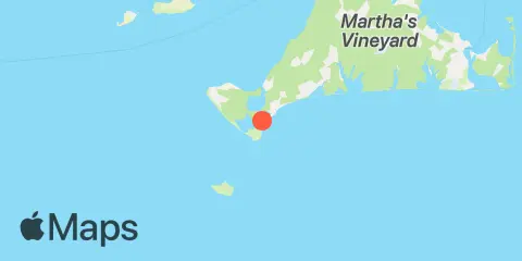
Squibnocket Point Map
Latitude
41° 18' 42" N (41.3117)
Longitude
70° 46' 6" W (-70.7683)
State
County
Nearest ZIP
02535
Nearby
Tides
3.0 mi
Menemsha Harbor
4.3 mi
Gay Head, Martha's Vineyard
4.3 mi
Nomans Land, Martha's Vineyard
9.3 mi
Martha's Vineyard GPS buoy, Martha's Vineyard
9.3 mi
Cedar Tree Neck, Martha's Vineyard
10.5 mi
Quicks Hole, North side
11.0 mi
Cuttyhunk
Currents
5.1 mi
Gay Head, 3 miles northeast of
6.1 mi
Gay Head, 1.5 miles northwest of
7.6 mi
Gay Head, 3 miles north of
8.5 mi
Robinsons Hole, 1.2 miles southeast of
9.5 mi
South end
9.8 mi
Robinsons Hole, Nashuon Point
10.0 mi
Middle
10.6 mi
North end
10.6 mi
Canapitsit Channel
11.1 mi
Gull I. and Nashawena I., between
11.3 mi
Tarpaulin Cove, 1.5 miles east of
12.1 mi
Norton Point, 0.5 mile north of
12.2 mi
Penikese Island, 0.2 mile south of