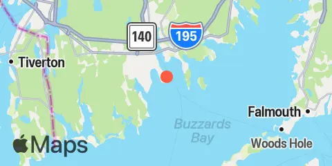
Clarks Point Map
Latitude
41° 35' 36" N (41.5933)
Longitude
70° 54' 0" W (-70.9)
State
County
Nearest ZIP
02744
Nearby
Tides
2.1 mi
New Bedford Harbor, Marine Terminal, Buzzards Bay
4.1 mi
Round Hill Point, Buzzards Bay
6.3 mi
Mattapoisett, Mattapoisett Harbor, Buzzards Bay
9.1 mi
Hix Bridge, East Branch, Westport River
10.0 mi
Penikese Island, Buzzards Bay
10.3 mi
Quicks Hole, North side
10.5 mi
Marion, Sippican Harbor, Buzzards Bay
11.1 mi
Uncatena Island (south side), Woods Hole
11.6 mi
Westport Harbor, Westport River
11.7 mi
Piney Point, Buzzards Bay
11.7 mi
Cuttyhunk
Currents
2.1 mi
New Bedford Hurricane Barrier
4.3 mi
Dumpling Rocks, 0.2 mile southeast of
5.0 mi
West Island, 1 mile Southeast of
9.1 mi
Penikese Island, 0.8 mile northwest of
10.1 mi
North end
10.3 mi
Weepecket Island, south of
10.5 mi
Penikese Island, 0.2 mile south of
10.8 mi
Middle
10.8 mi
Gull I. and Nashawena I., between
10.8 mi
Cleveland Ledge
11.0 mi
Robinsons Hole, Nashuon Point
11.1 mi
South end
11.4 mi
Westport River entrance
11.7 mi
Canapitsit Channel
11.8 mi
North end
12.3 mi
Woods Hole, The Strait
12.4 mi
Tarpaulin Cove, 1.5 miles east of
12.4 mi
Ribbon Reef-Sow & Pigs Reef, between