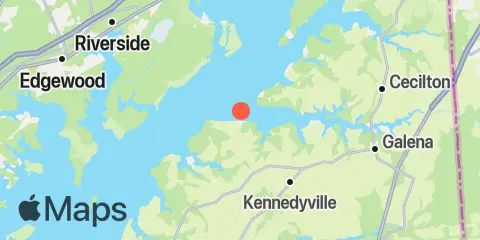
Latitude
39° 22' 18" N (39.3717)
Longitude
76° 3' 48" W (-76.0633)
State
County
Nearest ZIP
21610
Nearby
Tides
7.8 mi
Worton Creek entrance, Chesapeake Bay
10.3 mi
Pond Point (Aberdeen P.G.), Bush River, Chesapeake Bay
11.4 mi
Chestertown, Chester River
11.5 mi
Crumpton, Chester River
11.5 mi
Havre de Grace, Susquehanna River
12.0 mi
Town Point Wharf, Elk River
Currents
1.2 mi
Grove Point
1.8 mi
Grove Point, 0.7 n.mi.NW of
2.8 mi
Howell Point, 0.4 mile NNW of
3.6 mi
Howell Point, 0.8 n.mi. west of
4.1 mi
Ordinary Point, 0.4 mile west of
5.2 mi
Turkey Point, 1.2 n.mi. SW of
7.6 mi
Spesutie Island, channel north of
7.8 mi
Worton Point, 1.1 miles northwest of
8.0 mi
Arnold Point, 0.4 mile west of
8.8 mi
Rocky Pt. (Elk Neck), 0.25 n.mi. SW of
9.2 mi
Worton Point, 1.5 n.mi. WSW of
9.5 mi
Georgetown
10.4 mi
Bush River, 0.4 mi. SW of Bush Point
11.0 mi
Pooles Island, 1.6 n.mi. east of
11.4 mi
Chestertown
11.7 mi
Red Point, 0.2 mile W of, Northeast River
12.0 mi
Old Town Point Wharf, northwest of
12.2 mi
Robins Point, 0.7 mile ESE of
