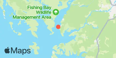
Latitude
38° 15' 42" N (38.2617)
Longitude
75° 55' 12" W (-75.92)
State
County
Nearest ZIP
21840
Nearby
Tides
3.7 mi
Great Shoals Light, Monie Bay, Chesapeake Bay
5.3 mi
McCready's Creek, Fishing Bay, Chesapeake Bay
5.5 mi
Sharkfin Shoal Light, Chesapeake Bay
6.4 mi
Chance, Chesapeake Bay
7.0 mi
Bishops Head, Hooper Strait
7.2 mi
Whitehaven, Wicomico River
8.8 mi
Hooper Strait Light, Chesapeake Bay
11.5 mi
Teague Creek, Manokin River, Chesapeake Bay
Currents
0.2 mi
Roaring Point, WSW of Nanticoke River
1.1 mi
Sandy Point, Nanticoke River
3.5 mi
Victor Point, 0.8 mile southwest of
3.5 mi
Long Point and Nanticoke Point, between
4.0 mi
Frog Point, 1.6 miles south of
4.6 mi
Fishing Bay Entrance, at Buoy '2'
7.0 mi
Whitehaven
8.4 mi
Hooper Strait, at Buoy '4'
8.5 mi
Chapter Point, Nanticoke River
8.8 mi
Deal Is., 0.6 n.mi. W. of, at Bouy '14'
9.1 mi
Whitehaven, 2.5 miles above
10.4 mi
Hooper Strait (west), at buoy '2'
10.7 mi
Honga River Entrance, at Buoy '1A'
11.5 mi
Manokin R. Ent., 1.1 n.mi. E of Drum Pt
