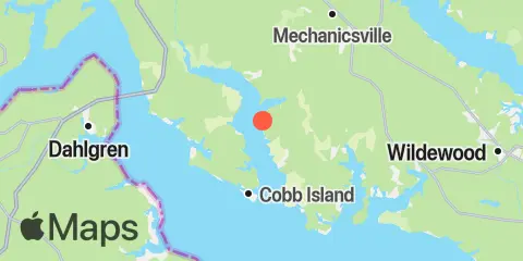
Latitude
38° 19' 36" N (38.3267)
Longitude
76° 49' 60" W (-76.8333)
State
County
Nearest ZIP
20621
Nearby
Tides
7.8 mi
Lower Cedar Point, Potomac River
8.5 mi
Colton Point, Potomac River
8.6 mi
Colonial Beach, Potomac River
11.0 mi
Dahlgren, Upper Machodoc Creek, Potomac River
Currents
3.7 mi
Rock Point, Wicomico River entrance
7.1 mi
Swan Point
8.6 mi
Potomac River Bridge, 0.4 mile south of
9.0 mi
Persimmon Point
9.5 mi
Breton Bay entrance
10.1 mi
St. Clements I., 1.1 miles southwest of
11.4 mi
St. Clements I., 1.8 miles southeast of
