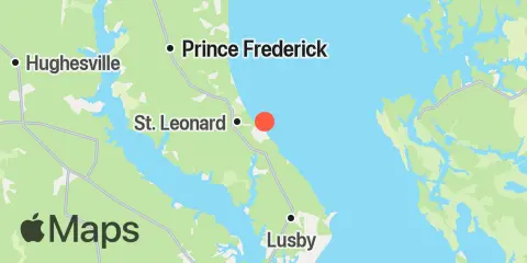
Latitude
38° 27' 54" N (38.465)
Longitude
76° 28' 24" W (-76.4733)
State
County
Nearest ZIP
20685
Nearby
Tides
5.2 mi
Broomes Island, Patuxent River
6.5 mi
Cove Point, Chesapeake Bay
9.7 mi
Taylors Island, Slaughter Creek, Little Choptank River
10.3 mi
Solomons Island, Patuxent River
11.2 mi
Benedict, Patuxent River
Currents
3.7 mi
Kenwood Beach, 1.5 miles northeast of
5.1 mi
James Island, 3.4 miles west of
5.2 mi
Cove Point, 4.9 n.mi. NNE of
6.1 mi
James Island, 1.6 n.mi. SW of
6.4 mi
James Island, 2.5 miles WNW of
6.5 mi
Cove Point, 1.0 n.mi. N of
6.5 mi
Broomes Island, 0.4 mile south of
8.4 mi
Cove Point, 1.1 n.mi. east of
9.5 mi
Sheridan Point, 0.1 mile southwest of
9.5 mi
Point Patience, 0.1 mile southwest of
9.9 mi
Cove Point, 2.7 n.mi. east of
10.2 mi
Plum Point, 1.4 miles ESE of
10.7 mi
Drum Point, 0.3 mile SSE of
10.9 mi
Sandy Point, 0.5 mile south of
10.9 mi
Hog Point, 0.6 n.mi. north of
11.2 mi
Benedict, highway bridge
11.3 mi
Cove Point, 3.9 n.mi. east of
11.9 mi
Sharp Island Lt., 2.3 n.mi. SE of
