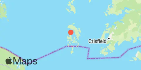
Latitude
37° 59' 42" N (37.995)
Longitude
76° 1' 54" W (-76.0317)
State
County
Nearest ZIP
21824
Nearby
Tides
6.2 mi
Holland Island Bar Light, Chesapeake Bay
9.3 mi
Crisfield, Little Annemessex River, Chesapeake Bay
11.7 mi
Ape Hole Creek, Pocomoke Sound, Chesapeake Bay
11.7 mi
Tangier Island, Chesapeake Bay
Currents
4.3 mi
Kedges Strait Buoy '4'
5.0 mi
Smith Island, 3.6 n.mi. northwest of
6.7 mi
Janes Island Light, 2.3 n.mi. NNE OF
7.2 mi
Clump Island, 2.5 n.mi. west of
7.9 mi
Smith Point Light, 6.7 n.mi. east of
8.7 mi
Smith Point Light, 4.5 n.mi. east of
8.7 mi
Smith Point Light, 6 miles north of
9.4 mi
Point Lookout, 5.9 n.mi. ESE of
9.4 mi
Smith Point Light, 3.0 n.mi. east of
10.2 mi
Big Annemessex River Entrance
10.4 mi
Smith Point Light, 1.5 n.mi. east of
10.4 mi
Manokin R. Ent., 1.1 n.mi. E of Drum Pt
10.6 mi
Deal Is., 0.6 n.mi. W. of, at Bouy '14'
11.3 mi
Adams Island, 1.1 n.mi. west of
11.8 mi
Smith Point Light, 0.8 n.mi. NW of
12.3 mi
Adams Island, 3.4 n.mi west of
