Deep Landing Weekly Tide Tables and Charts
Tide Chart for Next 7 Days
Deep Landing weekly tide chart key:
The tide chart above shows the times and heights of high tide and low tide for Deep Landing, for the next seven days. The red line highlights the current time and estimated height.The tidal range at Deep Landing for the next seven days is approximately 1.68 ft with a minimum tide of 0.36 ft and maximum tide of 2.04 ft. You can also check out all the daily details on tides & fishing times on the Day tab for Deep Landing.
Tide Table for Next 7 Days
▲ Blue = High Tide
▼ Red = Low Tide
| Day | 1st Tide | 2nd Tide | 3rd Tide | 4th Tide | ☀ Sun |
Major Solunars
|
Minor Solunars
|
|
|---|---|---|---|---|---|---|---|---|
| 19 Sat |
|
▲ 1.9 ft |
▼ 0.83 ft |
▲ 1.21 ft |
▼ 0.36 ft |
▲ 5:55 AM ▼ 8:28 PM |
8:06 AM → 10:06 AM 8:29 PM → 10:29 PM |
12:44 AM → 1:44 AM 3:37 PM → 4:37 PM |
| 20 Sun |
|
▲ 1.97 ft |
▼ 0.79 ft |
▲ 1.14 ft |
▼ 0.36 ft |
▲ 5:55 AM ▼ 8:27 PM |
9:03 AM → 11:03 AM 9:30 PM → 11:30 PM |
1:22 AM → 2:22 AM 4:53 PM → 5:53 PM |
| 21 Mon |
|
▲ 2.02 ft |
▼ 0.75 ft |
▲ 1.12 ft |
▼ 0.37 ft |
▲ 5:56 AM ▼ 8:26 PM |
10:05 AM → 12:05 PM 10:35 PM → 12:35 AM |
2:08 AM → 3:08 AM 6:05 PM → 7:05 PM |
| 22 Tue |
|
▲ 2.04 ft |
▼ 0.72 ft |
▲ 1.15 ft |
▼ 0.36 ft |
▲ 5:57 AM ▼ 8:26 PM |
11:08 AM → 1:08 PM 11:40 PM → 1:40 AM |
3:05 AM → 4:05 AM 7:09 PM → 8:09 PM |
| 23 Wed |
|
▲ 2.03 ft |
▼ 0.69 ft |
▲ 1.21 ft |
▲ 5:58 AM ▼ 8:25 PM | 12:11 PM → 2:11 PM |
4:12 AM → 5:12 AM 8:02 PM → 9:02 PM |
|
| 24 Thu |
|
▼ 0.38 ft |
▲ 2 ft |
▼ 0.66 ft |
▲ 1.29 ft |
▲ 5:59 AM ▼ 8:24 PM |
12:44 AM → 2:44 AM 1:09 PM → 3:09 PM |
5:25 AM → 6:25 AM 8:45 PM → 9:45 PM |
| 25 Fri |
|
▼ 0.42 ft |
▲ 1.94 ft |
▼ 0.62 ft |
▲ 1.37 ft |
▲ 6:00 AM ▼ 8:23 PM |
1:41 AM → 3:41 AM 2:03 PM → 4:03 PM |
6:38 AM → 7:38 AM 9:18 PM → 10:18 PM |
Buoy Weather
Air Temperature
82.0° F
Water Temperature
85.8° F
Wind
9.9 knots N (10°)
Wind Gust
13 knots
Atmospheric Pressure
29.97 in
Note: Observations are from a weather buoy 4.78 miles from the prediction site. Observations are not available at all prediction sites, and observation types vary between sites.
More details: Station tcbm2 Buoy Weather
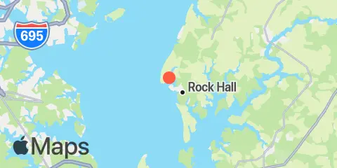
Location & Map
Latitude
39° 8' 42" N (39.145)
Longitude
76° 15' 36" W (-76.26)
State
County
Nearest ZIP
21661
Nearby
Tides
4.8 mi
Tolchester Beach, Chesapeake Bay
6.9 mi
Cliffs Point, Chester River
7.0 mi
Cliffs Wharf, Chester River
8.1 mi
Love Point, Chester River
10.4 mi
Cornfield Creek, Magothy River, Chesapeake Bay
10.5 mi
North Point, Patapsco River
10.9 mi
Mountain Point, Magothy River, Chesapeake Bay
11.4 mi
Chestertown, Chester River
11.5 mi
Worton Creek entrance, Chesapeake Bay
11.6 mi
Queenstown, Chester River
11.8 mi
Centreville Landing, Corsica River, Chester River
12.4 mi
Kent Island Narrows, Chesapeake Bay
Currents
2.7 mi
Swan Point, 1.6 miles northwest of
2.8 mi
Tolchester Channel, SW of Bouy '58B'
3.2 mi
Tolchester Channel, Buoy '22'
3.5 mi
Swan Point, 2.7 n.mi. SW of
3.6 mi
Tolchester Channel, south of Buoy '38B'
3.7 mi
Swan Point, 2.6 n.mi. west of
5.0 mi
Tolchester Beach, 0.33 n.mi. west of
5.3 mi
Love Point, 2.5 miles north of
5.4 mi
Love Point, 2.0 nmi north of
6.8 mi
Pooles Island, 4 miles southwest of
7.0 mi
Craighill Angle, right outside quarter
7.1 mi
Brewerton Channel Eastern Ext., Buoy '7'
7.3 mi
Pooles Island 2.0 n.mi. SSW of
7.7 mi
Love Point, 1.6 n.mi. east of
7.9 mi
Craighill Channel, Belvidere Shoal
7.9 mi
Deep Point
8.1 mi
Pooles Island, 0.8 mile south of
8.5 mi
Craighill Channel, NE of Mountain Pt
8.7 mi
North Point, 2.5 miles northeast of
9.1 mi
Pooles Island, 1.6 n.mi. east of
9.6 mi
Craighill Channel entrance, Buoy '2C'
9.8 mi
Miller Island, 1.5 miles ENE of
10.2 mi
Hail Point, 0.7 n.mi.east of
10.4 mi
Robins Point, 0.7 mile ESE of
10.8 mi
Baltimore Harbor Approach (off Sandy Point)
10.9 mi
Sandy Point, 2.3 n.mi. east of
11.3 mi
Mountain Point, Magothy River entrance
11.5 mi
Chestertown
11.7 mi
Sandy Point, 0.8 n.mi. ESE of
11.8 mi
Worton Point, 1.5 n.mi. WSW of
11.8 mi
Gunpowder River entrance
12.0 mi
Lynch Point, Back River
12.1 mi
Kent Island Narrows (highway bridge)
Note: Tide predictions are an estimate and NOT FOR NAVIGATION.
We also offer free widgets if you want to add tide or solunar tables to your own site.