Mackerel Cove Weekly Tide Tables and Charts
Tide Chart for Next 7 Days
Mackerel Cove weekly tide chart key:
The tide chart above shows the times and heights of high tide and low tide for Mackerel Cove, for the next seven days. The red line highlights the current time and estimated height.The tidal range at Mackerel Cove for the next seven days is approximately 13.04 ft with a minimum tide of -0.94 ft and maximum tide of 12.1 ft. You can also check out all the daily details on tides & fishing times on the Day tab for Mackerel Cove.
Tide Table for Next 7 Days
▲ Blue = High Tide
▼ Red = Low Tide
| Day | 1st Tide | 2nd Tide | 3rd Tide | 4th Tide | ☀ Sun |
Major Solunars
|
Minor Solunars
|
|
|---|---|---|---|---|---|---|---|---|
| 26 Sat |
|
▲ 12.1 ft |
▼ -0.94 ft |
▲ 10.67 ft |
▼ 0.38 ft |
▲ 5:15 AM ▼ 8:05 PM |
2:01 AM → 4:01 AM 2:19 PM → 4:19 PM |
7:05 AM → 8:05 AM 9:20 PM → 10:20 PM |
| 27 Sun |
|
▲ 11.79 ft |
▼ -0.68 ft |
▲ 10.64 ft |
▼ 0.55 ft |
▲ 5:16 AM ▼ 8:04 PM |
2:48 AM → 4:48 AM 3:04 PM → 5:04 PM |
8:16 AM → 9:16 AM 9:40 PM → 10:40 PM |
| 28 Mon |
|
▲ 11.33 ft |
▼ -0.29 ft |
▲ 10.51 ft |
▼ 0.81 ft |
▲ 5:17 AM ▼ 8:02 PM |
3:32 AM → 5:32 AM 3:46 PM → 5:46 PM |
9:24 AM → 10:24 AM 9:57 PM → 10:57 PM |
| 29 Tue |
|
▲ 10.76 ft |
▼ 0.22 ft |
▲ 10.31 ft |
▼ 1.11 ft |
▲ 5:19 AM ▼ 8:01 PM |
4:13 AM → 6:13 AM 4:27 PM → 6:27 PM |
10:29 AM → 11:29 AM 10:14 PM → 11:14 PM |
| 30 Wed |
|
▲ 10.13 ft |
▼ 0.78 ft |
▲ 10.06 ft |
▼ 1.42 ft |
▲ 5:20 AM ▼ 8:00 PM |
4:53 AM → 6:53 AM 5:07 PM → 7:07 PM |
11:33 AM → 12:33 PM 10:31 PM → 11:31 PM |
| 31 Thu |
|
▲ 9.51 ft |
▼ 1.34 ft |
▲ 9.81 ft |
▼ 1.69 ft |
▲ 5:21 AM ▼ --:-- |
5:34 AM → 7:34 AM 5:49 PM → 7:49 PM |
12:38 PM → 1:38 PM 10:50 PM → 11:50 PM |
| 1 Fri |
|
▲ 8.96 ft |
▼ 1.84 ft |
▲ 9.6 ft |
▼ 1.86 ft |
▲ 5:22 AM ▼ 7:58 PM |
6:16 AM → 8:16 AM 6:32 PM → 8:32 PM |
1:42 PM → 2:42 PM 11:13 PM → 12:13 AM |
Buoy Weather
Air Temperature
60.4° F
Water Temperature
54.1° F
Wind
7.8 knots NW (310°)
Wind Gust
9.7 knots
Note: Observations are from a weather buoy 16.69 miles from the prediction site. Observations are not available at all prediction sites, and observation types vary between sites.
More details: Station 44034 Buoy Weather
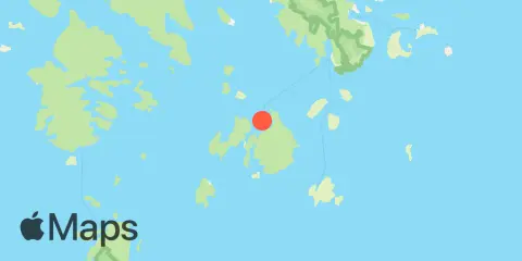
Location & Map
Latitude
44° 10' 12" N (44.17)
Longitude
68° 26' 6" W (-68.435)
State
County
Nearest ZIP
04685
Nearby
Tides
1.9 mi
Burnt Coat Harbor, Swans Island
6.4 mi
Bass Harbor, Mount Desert Island
9.3 mi
Oceanville, Deer Isle, Penobscot Bay
9.4 mi
Southwest Harbor, Mount Desert Island
9.9 mi
Center Harbor, Eggemoggin Reach
11.3 mi
Stonington, Deer Isle, Penobscot Bay
12.0 mi
Isle Au Haut, Penobscot Bay
Currents
2.3 mi
Casco Passage, east end, Blue Hill Bay
3.9 mi
Hat Island, SE of, Jericho Bay
8.4 mi
Clam I., NW of, Deer I. Thorofare
9.2 mi
Grog Island, E of, Deer Island Thorofare
9.5 mi
Isle au Haut, 0.8 mile E of Rich's Pt
10.5 mi
Russ Island, N of, Deer Island Thorofare
Note: Tide predictions are an estimate and NOT FOR NAVIGATION.
We also offer free widgets if you want to add tide or solunar tables to your own site.