Saybrook Jetty Weekly Tide Tables and Charts
Tide Chart for Next 7 Days
Saybrook Jetty weekly tide chart key:
The tide chart above shows the times and heights of high tide and low tide for Saybrook Jetty, for the next seven days. The red line highlights the current time and estimated height.The tidal range at Saybrook Jetty for the next seven days is approximately 4.87 ft with a minimum tide of -0.38 ft and maximum tide of 4.49 ft. You can also check out all the daily details on tides & fishing times on the Day tab for Saybrook Jetty.
Tide Table for Next 7 Days
▲ Blue = High Tide
▼ Red = Low Tide
| Day | 1st Tide | 2nd Tide | 3rd Tide | 4th Tide | ☀ Sun |
Major Solunars
|
Minor Solunars
|
|
|---|---|---|---|---|---|---|---|---|
| 2 Wed |
|
1:59 AM ▲ 4.49 ft |
8:27 AM ▼ -0.38 ft |
2:30 PM ▲ 3.25 ft |
8:28 PM ▼ 0.22 ft |
▲ 6:30 AM ▼ 7:16 PM |
4:21 AM → 6:21 AM 4:53 PM → 6:53 PM |
8:50 AM → 9:50 AM |
| 3 Thu |
|
3:00 AM ▲ 4.21 ft |
9:28 AM ▼ -0.13 ft |
3:30 PM ▲ 3.1 ft |
9:32 PM ▼ 0.42 ft |
▲ 6:29 AM ▼ 7:17 PM |
5:24 AM → 7:24 AM 5:55 PM → 7:55 PM |
1:06 AM → 2:06 AM 9:43 AM → 10:43 AM |
| 4 Fri |
|
4:04 AM ▲ 3.91 ft |
10:29 AM ▼ 0.1 ft |
4:34 PM ▲ 3 ft |
10:40 PM ▼ 0.55 ft |
▲ 6:27 AM ▼ 7:18 PM |
6:28 AM → 8:28 AM 6:55 PM → 8:55 PM |
2:10 AM → 3:10 AM 10:46 AM → 11:46 AM |
| 5 Sat |
|
5:15 AM ▲ 3.64 ft |
11:32 AM ▼ 0.28 ft |
5:44 PM ▲ 2.99 ft |
11:50 PM ▼ 0.59 ft |
▲ 6:25 AM ▼ 7:19 PM |
7:28 AM → 9:28 AM 7:51 PM → 9:51 PM |
3:01 AM → 4:01 AM 11:55 AM → 12:55 PM |
| 6 Sun |
|
6:30 AM ▲ 3.48 ft |
12:33 PM ▼ 0.37 ft |
6:54 PM ▲ 3.09 ft |
▲ 6:24 AM ▼ 7:20 PM |
8:23 AM → 10:23 AM 8:43 PM → 10:43 PM |
3:41 AM → 4:41 AM 1:05 PM → 2:05 PM |
|
| 7 Mon |
|
12:56 AM ▼ 0.56 ft |
7:36 AM ▲ 3.42 ft |
1:30 PM ▼ 0.4 ft |
7:52 PM ▲ 3.27 ft |
▲ 6:22 AM ▼ 7:21 PM |
9:12 AM → 11:12 AM 9:31 PM → 11:31 PM |
4:12 AM → 5:12 AM 2:13 PM → 3:13 PM |
| 8 Tue |
|
1:56 AM ▼ 0.48 ft |
8:28 AM ▲ 3.39 ft |
2:20 PM ▼ 0.4 ft |
8:40 PM ▲ 3.47 ft |
▲ 6:21 AM ▼ 7:22 PM |
9:58 AM → 11:58 AM 10:15 PM → 12:15 AM |
4:37 AM → 5:37 AM 3:19 PM → 4:19 PM |
Current Weather
Air Temperature
36.1° F
Water Temperature
44.8° F
Atmospheric Pressure
30.38 in
Note: Observations are from a weather buoy 14.88 miles from the prediction site. Observations are not available at all prediction sites, and the number/type of observations varies between sites.
More details: Station nlhc3 Buoy Weather
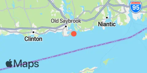
Location & Map
Latitude
41° 15' 48" N (41.2633)
Longitude
72° 20' 36" W (-72.3433)
State
County
Nearest ZIP
06475
Nearby
Tides
1.4 mi
Saybrook Point, Connecticut River
4.1 mi
Lyme, highway bridge, Connecticut River
6.3 mi
Essex, Connecticut River
6.9 mi
Westbrook, Duck Island Roads
9.0 mi
Orient Harbor, Orient, Shelter Island Sound
9.2 mi
Niantic, Niantic River
9.6 mi
Plum Gut Harbor, Plum Island, Long Island
9.8 mi
Clinton Harbor
11.3 mi
Greenport, Shelter Island Sound
11.7 mi
Hadlyme, Connecticut River
12.0 mi
Hashamomuck Beach, Long Island
Currents
0.4 mi
Saybrook Breakwater Light
1.4 mi
Saybrook Channel
1.8 mi
Saybrook Breakwater, 1.5 miles SE of
2.1 mi
Cornfield Point, 2.8 n.mi. SE of
2.8 mi
Cornfield Point, 1.1 miles south of
3.2 mi
Hatchett Point, 1.1 miles WSW of
3.8 mi
I-95 Bridge
4.3 mi
Cornfield Point, 1.9 n.mi. SW of
4.6 mi
Hatchett Point, 1.6 n.mi. S of
4.6 mi
Mulford Point, 3.1 miles northwest of
5.3 mi
Cornfield Point, 4 miles south of, Buoy CF
6.6 mi
Kelsey Point, 2.1 miles southeast of
7.0 mi
Black Point, 0.8 mile south of
7.5 mi
Black Point and Plum Island, between
7.9 mi
Six Mile Reef, 2 miles east of
8.0 mi
Six Mile Reef, 1.5 miles north of
8.2 mi
Orient Point, 1 mile WNW of
8.3 mi
Rocky Point, 0.3 mile north of
8.4 mi
Kelsey Point, 1 mile south of
8.8 mi
Plum Island, 0.8 mile NNW of
9.1 mi
Plum Island, 3nm. North of, Buoy PI
9.2 mi
Eustasia Island, 0.6 mile ESE of
9.7 mi
Niantic (Railroad Bridge)
10.1 mi
Plum Gut
10.4 mi
Six mile Reef, 1 mile south of
10.8 mi
Twotree Island Channel
10.9 mi
Bartlett Reef, 0.2 mile south of
11.2 mi
Long Beach Pt., 0.7 mile southwest of
11.7 mi
Six Mile Reef, 2 miles south of, Buoy TE
11.8 mi
Hammonasset Point, 1.2 miles SW of
11.9 mi
Great Gull Island, SW of
12.0 mi
Orient Point, 2.4 miles SSE of
12.2 mi
Gardiners Point & Plum Island, between
12.2 mi
Little Gull Island, 0.8 mile NNW of
12.3 mi
Ram Island, 1.4 miles NNE of
12.3 mi
Six Mile Reef, 1 mile west of
12.4 mi
Goshen Point, 1.9 miles SSE of
Note: Tide predictions are an estimate and NOT FOR NAVIGATION.
We also offer free widgets if you want to add tide or solunar tables to your own site.