Waldron Island Weekly Tide Tables and Charts
Tide Chart for Next 7 Days
Waldron Island weekly tide chart key:
The tide chart above shows the times and heights of high tide and low tide for Waldron Island, for the next seven days. The red line highlights the current time and estimated height.The tidal range at Waldron Island for the next seven days is approximately 8.94 ft with a minimum tide of -0.6 ft and maximum tide of 8.34 ft. You can also check out all the daily details on tides & fishing times on the Day tab for Waldron Island.
Tide Table for Next 7 Days
▲ Blue = High Tide
▼ Red = Low Tide
| Day | 1st Tide | 2nd Tide | 3rd Tide | 4th Tide | ☀ Sun |
Major Solunars
|
Minor Solunars
|
|
|---|---|---|---|---|---|---|---|---|
| 29 Tue |
|
▼ 3.89 ft |
▲ 5.31 ft |
▼ 1.52 ft |
▲ 8.07 ft |
▲ 5:43 AM ▼ 8:54 PM |
4:58 AM → 6:58 AM 5:11 PM → 7:11 PM |
11:20 AM → 12:20 PM 10:50 PM → 11:50 PM |
| 30 Wed |
|
▼ 3.1 ft |
▲ 4.92 ft |
▼ 2.78 ft |
▲ 7.84 ft |
▲ 5:44 AM ▼ 8:52 PM |
5:39 AM → 7:39 AM 5:53 PM → 7:53 PM |
12:28 PM → 1:28 PM 11:04 PM → 12:04 AM |
| 31 Thu |
|
▼ 2.36 ft |
▲ 4.87 ft |
▼ 3.98 ft |
▲ 7.69 ft |
▲ 5:45 AM ▼ 8:51 PM |
6:20 AM → 8:20 AM 6:34 PM → 8:34 PM |
1:36 PM → 2:36 PM 11:19 PM → 12:19 AM |
| 1 Fri |
|
▼ 1.69 ft |
▲ 5.27 ft |
▼ 5.08 ft |
▲ 7.63 ft |
▲ 5:47 AM ▼ 8:49 PM |
7:02 AM → 9:02 AM 7:18 PM → 9:18 PM |
2:45 PM → 3:45 PM 11:38 PM → 12:38 AM |
| 2 Sat |
|
▼ 1.08 ft |
▲ 7.63 ft |
▲ 5:48 AM ▼ 8:48 PM |
7:46 AM → 9:46 AM 8:05 PM → 10:05 PM |
3:54 PM → 4:54 PM |
||
| 3 Sun |
|
▼ 0.5 ft |
▲ 7.64 ft |
▲ 5:49 AM ▼ 8:46 PM |
8:32 AM → 10:32 AM 8:54 PM → 10:54 PM |
12:03 AM → 1:03 AM 5:02 PM → 6:02 PM |
||
| 4 Mon |
|
▼ -0.06 ft |
▲ 7.4 ft |
▼ 7.3 ft |
▲ 7.62 ft |
▲ 5:51 AM ▼ 8:45 PM |
9:24 AM → 11:24 AM 9:47 PM → 11:47 PM |
12:36 AM → 1:36 AM 6:12 PM → 7:12 PM |
Buoy Weather
Air Temperature
54.3° F
Water Temperature
52.0° F
Wind
1 knots W (280°)
Wind Gust
1 knots
Atmospheric Pressure
30.14 in
Note: Observations are from a weather buoy 9.88 miles from the prediction site. Observations are not available at all prediction sites, and observation types vary between sites.
More details: Station frdw1 Buoy Weather
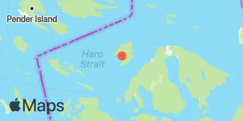
Location & Map
Latitude
48° 41' 12" N (48.6868)
Longitude
123° 2' 15" W (-123.0376)
State
County
Nearest ZIP
98245
Nearby
Tides
7.2 mi
Orcas, Orcas Island
7.5 mi
Roche Harbor, San Juan Island, Haro Strait
7.6 mi
Patos Island Wharf, Boundary Pass
8.0 mi
Echo Bay, Sucia Islands, Strait of Georgia
8.1 mi
Rosario, East Sound, Orcas Island
8.6 mi
Shaw Island, Ferry Terminal, Harney Channel, San Juan Channel
9.5 mi
Hanbury Point, Mosquito Pass, San Juan I., Haro Strait
9.8 mi
Friday Harbor, San Juan Island, San Juan Channel
10.6 mi
Upright Head, Lopez Island
12.4 mi
Peavine Pass
Currents
1.7 mi
President Channel, East of Point Disney
3.2 mi
Point Hammond, 1.1 miles northwest of
3.3 mi
Waldron Island, 1.7 nm west of
4.5 mi
Skipjack Island, 1.5 miles northwest of
5.1 mi
Johns Island, 0.8 mile north of
5.2 mi
Spring Passage, south entrance
5.3 mi
Spieden Channel, north of Limestone Point
5.6 mi
Alden Point, Patos Island, 2 miles S of
6.1 mi
Patos Island Light, 1.4 nm west of
6.9 mi
Wasp Passage narrows
7.6 mi
Patos Island, south of Toe Point
7.6 mi
Parker Reef Light, north of
8.6 mi
Harney Channel, north of Point Hudson
8.9 mi
Matia Island, 0.8 mile west of
9.2 mi
Point George, west of
9.5 mi
Turn Point, Boundary Pass
9.6 mi
Raccoon Point, 0.6 mile NNE of
10.6 mi
Upright Channel narrows
10.8 mi
Matia Island, west of
11.0 mi
Haro Strait, 1.2 nm west of Kellett Bluff
11.4 mi
Barnes Island, 0.8 mile southwest of
11.8 mi
Obstruction Pass, north of Obstruction Island
12.1 mi
Peavine Pass, west entrance
Note: Tide predictions are an estimate and NOT FOR NAVIGATION.
We also offer free widgets if you want to add tide or solunar tables to your own site.