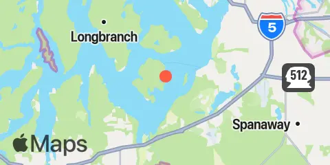
Sandy Point, Anderson Island Map
Latitude
47° 9' 11" N (47.153)
Longitude
122° 40' 30" W (-122.6751)
State
County
Nearest ZIP
98303
Nearby
Tides
1.9 mi
Yoman Point, Anderson Island, Balch Passage, Puget Sound
2.4 mi
Dupont Wharf, Nisqually Reach, Puget Sound
3.7 mi
Steilacoom, Cormorant Passage, Puget Sound
4.2 mi
Devils Head, Drayton Passage, Puget Sound
5.4 mi
Longbranch, Filucy Bay, Puget Sound
7.7 mi
Henderson Inlet, Puget Sound
8.8 mi
Arletta, Hale Passage, Puget Sound
9.3 mi
Home, Von Geldern Cove, Carr Inlet, Puget Sound
10.0 mi
Tacoma Narrows Bridge, Puget Sound
10.3 mi
Horsehead Bay, Carr Inlet, Puget Sound
10.7 mi
Dofflemeyer Point, Boston Hbr., Budd Inlet, Puget Sound
10.9 mi
McMicken Island, Case Inlet, Puget Sound
11.0 mi
Budd Inlet, south of Gull Harbor
Currents
0.8 mi
Ketron Island, West of
2.7 mi
Balch Passage, NE of Eagle Island
2.7 mi
Nisqually Reach, 0.5 miles South of Lyle Point
3.4 mi
Drayton Passage
3.8 mi
Steilacoom, 0.8 miles North of
5.2 mi
Pitt Passage, NE of Pitt Island
5.4 mi
Devils Head, West of
6.1 mi
Gibson Point, 0.8 miles East of
7.6 mi
Hale Passage, East end
8.9 mi
Hale Passage, West end
9.1 mi
Dana Passage
9.3 mi
The Narrows, South end (midstream)
10.1 mi
Peale Passage, South end
10.4 mi
The Narrows, 0.3 miles North of Bridge
11.6 mi
Squaxin Passage, North of Hunter Point
11.6 mi
Budd Inlet Entrance
11.8 mi
The Narrows, North End (west side)
12.1 mi
The Narrows, North end - midstream
12.1 mi
Peale Passage, North end
12.2 mi
Eld Inlet entrance