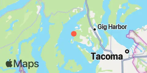
Latitude
47° 18' 6" N (47.3017)
Longitude
122° 40' 55" W (-122.682)
State
County
Nearest ZIP
98335
Nearby
Tides
2.1 mi
Arletta, Hale Passage, Puget Sound
4.0 mi
Home, Von Geldern Cove, Carr Inlet, Puget Sound
5.1 mi
Gig Harbor, Puget Sound
5.2 mi
Vaughn, Case Inlet, Puget Sound
5.8 mi
Wauna, Carr Inlet, Puget Sound
6.4 mi
Tacoma Narrows Bridge, Puget Sound
7.2 mi
Longbranch, Filucy Bay, Puget Sound
8.4 mi
Yoman Point, Anderson Island, Balch Passage, Puget Sound
8.5 mi
Tahlequah, Neil Pt., Dalco Passage, Vashon I., Puget Sound
8.7 mi
Allyn, Case Inlet, Puget Sound
9.3 mi
McMicken Island, Case Inlet, Puget Sound
9.6 mi
Steilacoom, Cormorant Passage, Puget Sound
10.1 mi
Devils Head, Drayton Passage, Puget Sound
10.3 mi
Sandy Point, Anderson Island, Puget Sound
11.4 mi
Walkers Landing, Pickering Passage, Puget Sound
12.1 mi
Burton, Quartermaster Hbr. (Inside), Vashon I., Puget Sound
Currents
1.7 mi
Hale Passage, West end
5.4 mi
Gig Harbor Entrance
5.5 mi
Hale Passage, East end
5.6 mi
Pitt Passage, NE of Pitt Island
5.9 mi
The Narrows, North End (west side)
6.2 mi
The Narrows, North end - midstream
6.4 mi
The Narrows, South end (midstream)
6.7 mi
The Narrows, 0.3 miles North of Bridge
7.2 mi
Gibson Point, 0.8 miles East of
7.6 mi
Dalco Passage
7.7 mi
Balch Passage, NE of Eagle Island
7.9 mi
Pickering Passage, North end
8.9 mi
Point Richmond, East of, Colvos Passage
9.0 mi
Steilacoom, 0.8 miles North of
9.4 mi
Drayton Passage
10.6 mi
Ketron Island, West of
10.8 mi
Browns Point, 1.6 miles North of
11.0 mi
Devils Head, West of
12.0 mi
Anderson Point, East of, Colvos Passage
12.0 mi
Pickering Passage, off Graham Point
12.4 mi
Peale Passage, North end
