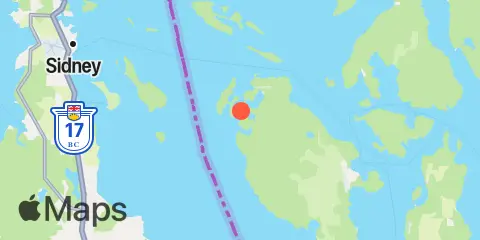
Latitude
48° 34' 54" N (48.5817)
Longitude
123° 10' 12" W (-123.17)
State
County
Nearest ZIP
98250
Nearby
Tides
2.1 mi
Roche Harbor, San Juan Island, Haro Strait
7.6 mi
Friday Harbor, San Juan Island, San Juan Channel
7.8 mi
Kanaka Bay, San Juan Island, Haro Strait
9.5 mi
Waldron Island, Haro Strait
10.1 mi
Orcas, Orcas Island
11.1 mi
Shaw Island, Ferry Terminal, Harney Channel, San Juan Channel
Currents
2.6 mi
Haro Strait, 1.2 nm west of Kellett Bluff
4.2 mi
Spieden Channel, north of Limestone Point
5.8 mi
South Haro Strait, south of Lime Kiln Light
6.5 mi
Spring Passage, south entrance
7.1 mi
Johns Island, 0.8 mile north of
8.0 mi
Point George, west of
8.3 mi
Wasp Passage narrows
8.3 mi
Turn Point, Boundary Pass
9.0 mi
Waldron Island, 1.7 nm west of
9.0 mi
Discovery Island, 3.0 nm NE of
9.8 mi
President Channel, East of Point Disney
11.1 mi
Pear Point, east of
11.4 mi
Harney Channel, north of Point Hudson
11.5 mi
Upright Channel narrows
11.9 mi
Kings Point, Lopez Island, 1 mile NNW of
12.3 mi
Point Hammond, 1.1 miles northwest of
