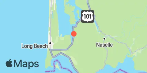
Latitude
46° 22' 20" N (46.3722)
Longitude
123° 57' 1" W (-123.9503)
State
County
Nearby
Tides
2.6 mi
Tarlatt Slough, Willapa Bay
4.6 mi
Naselle River, swing bridge, Willapa Bay
5.4 mi
Naselle River, 4 miles above swing bridge, Willapa Bay
6.4 mi
Ilwaco, Baker Bay
6.7 mi
Paradise Point, Long Island, Willapa Bay
7.0 mi
Chinook, Baker Bay
7.8 mi
Cape Disappointment
8.3 mi
Fort Canby, Jetty 'A'
9.0 mi
Columbia River entrance (N. Jetty)
9.3 mi
Hungry Harbor
9.6 mi
Nahcotta, Willapa Bay
11.8 mi
Hammond
11.9 mi
Point Adams
Currents
8.0 mi
Baker Bay entrance, E of Sand Island Tower
8.1 mi
Sand Island, SSE of
8.2 mi
Sand Island Tower, 0.9nm SE of (north channel)
8.5 mi
Sand Island Tower, 1nm SE of (midchannel)
9.0 mi
Clatsop Spit, NNE of
9.0 mi
Chinook Point, WSW of
9.3 mi
McGowan, SSW of
10.0 mi
Point Adams, NNE OF
10.3 mi
Point Ellice, east of
11.2 mi
Hammond, northeast of ship channel
