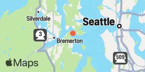
Clam Bay Map
Latitude
47° 34' 24" N (47.5733)
Longitude
122° 32' 35" W (-122.543)
State
County
Nearest ZIP
98366
Nearby
Tides
2.2 mi
Port Blakely, Puget Sound
3.5 mi
Eagle Harbor, Bainbridge Island, Puget Sound
3.7 mi
Harper, Yukon Harbor, Puget Sound
3.9 mi
Bremerton, Sinclair Inlet, Port Orchard, Puget Sound
5.7 mi
Point Vashon, Vashon Island, Puget Sound
6.0 mi
Tracyton, Dyes Inlet, Puget Sound
6.4 mi
Brownsville, Port Orchard, Puget Sound
8.5 mi
Lockheed Shipyard, Harbor Island, Puget Sound
9.1 mi
Port Madison, Puget Sound
9.7 mi
Seattle, Puget Sound
10.3 mi
Meadow Point, Shilshole Bay, Puget Sound
10.6 mi
Duwamish Waterway, Eighth Ave. South, Puget Sound
11.4 mi
Poulsbo, Liberty Bay, Puget Sound
12.4 mi
Port Jefferson, Puget Sound
Currents
0.7 mi
Rich Passage, East end
0.8 mi
Off Pleasant Beach
1.4 mi
Rich Passage, LB 8
1.5 mi
Rich Passage, West end
3.5 mi
Restoration Point
3.9 mi
Entrance to Eagle Harbor
4.1 mi
Port Washington Narrows, Warren Ave. Bridge
4.3 mi
Alki Point, 1 mile West of
4.5 mi
Blake Island, S of
5.4 mi
Alki Point, West of
7.5 mi
Dolphin Point, 1.3 miles East of
7.7 mi
West Point, West of
8.6 mi
Harbor Island West
9.3 mi
Anderson Point, East of, Colvos Passage
9.6 mi
Agate Passage, south end
10.1 mi
Liberty Bay (entrance), Port Orchard
10.3 mi
Agate Passage, north end
12.3 mi
Point Jefferson, East of