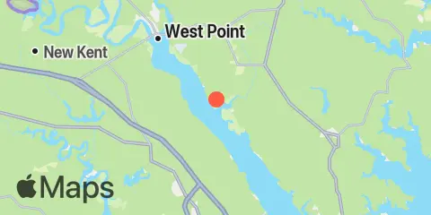
Latitude
37° 26' 48" N (37.4467)
Longitude
76° 42' 30" W (-76.7083)
State
County
Nearest ZIP
23156
Nearby
Tides
7.7 mi
West Point, York River
11.5 mi
Wright Island Landing, Chickahominy River
11.6 mi
Lanexa, Chickahominy River
Currents
2.5 mi
Purtan Island, 0.2 mile southwest of
4.0 mi
Allmondsville
5.5 mi
Goff Point, 0.8 mile SSW of
6.6 mi
West Point, 0.8 mile below
7.7 mi
Lord Delaware Bridge, 100 yds. S of
8.2 mi
Eltham Bridge, 100 yds. north of
8.7 mi
Clay Bank Pier, 100 yds. southwest of
12.1 mi
Blundering Point, 0.9 mile SSW of
