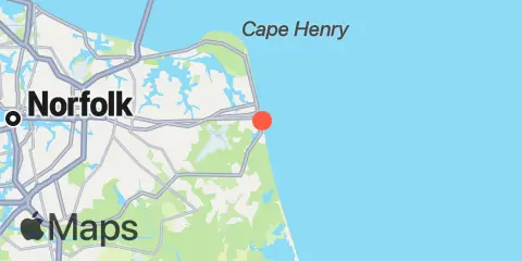
Inside Channel, Rudee Inlet Map
Latitude
36° 49' 54" N (36.8317)
Longitude
75° 58' 24" W (-75.9733)
State
Nearest ZIP
23451
Nearby
Tides
0.3 mi
Rudee Inlet entrance
0.5 mi
Rudee Heights, Lake Wesley
0.7 mi
Lake Rudee, South End
0.8 mi
Virginia Beach
5.7 mi
Brown Cove, Lynnhaven Bay
6.9 mi
Broad Bay Canal, Lynnhaven Bay
7.0 mi
Cape Henry
7.3 mi
Long Creek, Lynnhaven Bay
8.1 mi
Buchanan Creek entrance, Lynnhaven Bay
8.3 mi
Virginia pilot's dock, Lynnhaven Inlet, Chesapeake Bay
8.4 mi
Bayville, Lynnhaven Bay
10.1 mi
Sandbridge
12.1 mi
Chesapeake Bay Bridge-Tunnel
Currents
4.6 mi
Cape Henry Light, 2.2 miles southeast of
6.8 mi
Cape Henry Light, 0.7 mile east of
7.6 mi
Cape Henry Light, 0.8 n.mi. NNE of
7.9 mi
Cape Henry Light, 1.4nm NE of
8.4 mi
Lynnhaven Inlet bridge
8.5 mi
Lynnhaven Roads
9.1 mi
Cape Henry Light, 2.35nm NNE of
9.1 mi
Chesapeake Bay Ent., 2.0 n.mi. N of Cape Henry Lt.
10.3 mi
Cape Henry Light, 3.4nm NNE of
10.3 mi
Cape Henry Light, 3.2 miles north of
11.4 mi
Chesapeake Beach, 1.5 miles north of
11.8 mi
Cape Henry Light, 4.6 miles north of