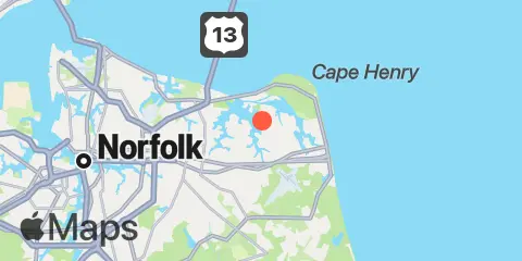
TidesPro
  • Recents
    • Brown Cove, Lynnhaven Bay
  • Tides
    United States
    Alabama Alaska California Connecticut Delaware District of Columbia Florida Georgia Hawaii
    Louisiana Maine Maryland Massachusetts Mississippi New Hampshire New Jersey New York North Carolina
    Oregon Pennsylvania Rhode Island South Carolina Texas US Outlying Islands Virginia Washington Puerto Rico
    Caribbean
    The Bahamas Cayman Islands Cuba Dominican Republic Haiti Jamaica Virgin Islands (US)
  • Fishing  Coordinates
    Alabama - Alabama Inshore Public Reefs Alabama - Alabama Nearshore Public Reefs Alabama - Alabama Offshore Public Reefs California - California Artificial Reefs Delaware - Delaware Artificial Reefs Florida - Bay County Florida - Brevard County Florida - Broward County Florida - Charlote and Lee Counties Florida - Citrus County Florida - Collier County Florida - Dixie County Florida - Duval County Florida - Escambia County Florida - Flagler County Florida - Florida Keys Florida - Franklin County Florida - Gulf County Florida - Hernando County
    Florida - Indian River County Florida - Levy County Florida - Manatee County Florida - Martin County Florida - Miami-Dade County Florida - Monroe County Florida - Nassau County Florida - Okaloosa County Florida - Palm Beach County Florida - Pasco County Florida - Santa Rosa County Florida - Sarasota County Florida - St. Johns County Florida - St. Lucie County Florida - Tampa Bay Florida - Taylor County Florida - Volusia County Florida - Wakulla County Florida - Walton County
    Georgia - Georgia Reefs Hawaii - Hawaii Artificial Reefs Louisiana - Louisiana Artificial Reefs Maryland - Maryland Artificial Reefs Massachusetts - Massachusetts Artificial Reefs Mississippi - Mississippi Inshore Artificial Reefs Mississippi - Mississippi Offshore Artificial Reefs New Jersey - New Jersey Artificial Reefs New York - New York Artificial Reefs North Carolina - Estuarine North Carolina - Long Bay North Carolina - Onslow Bay North Carolina - Outer Banks North Carolina - Raleigh Bay Puerto Rico - Puerto Rico Artificial Reefs Rhode Island - Rhode Island Artificial Reefs South Carolina - South Carolina Reefs Texas - Texas Artificial Reefs Virginia - Virginia Artificial Reefs
  • Solunar Tables
Brown Cove Location
  1. United States
  2. Virginia
  3. Brown Cove, Lynnhaven Bay

Brown Cove Map

Day Week Month Table Month Chart Map
Latitude
36° 52' 30" N (36.875)
Longitude
76° 3' 42" W (-76.0617)
State
Virginia
Nearest ZIP
23454
Nearby
Tides 1.8 mi Broad Bay Canal, Lynnhaven Bay 2.0 mi Long Creek, Lynnhaven Bay 2.7 mi Virginia pilot's dock, Lynnhaven Inlet, Chesapeake Bay 2.7 mi Bayville, Lynnhaven Bay 3.1 mi Buchanan Creek entrance, Lynnhaven Bay 4.9 mi Cape Henry 5.4 mi Virginia Beach 5.6 mi Lake Rudee, South End 5.7 mi Inside Channel, Rudee Inlet 5.9 mi Rudee Heights, Lake Wesley 6.0 mi Rudee Inlet entrance 6.8 mi Little Creek NAB, Chesapeake Bay 7.0 mi Chesapeake Bay Bridge-Tunnel 11.0 mi Chesapeake Bay Bridge-Tunnel, Chesapeake Bay 11.9 mi Lafayette River Currents 2.8 mi Lynnhaven Inlet bridge 3.2 mi Lynnhaven Roads 4.9 mi Cape Henry Light, 2.2 miles southeast of 5.3 mi Cape Henry Light, 0.7 mile east of 5.6 mi Cape Henry Light, 0.8 n.mi. NNE of 5.9 mi Chesapeake Beach, 1.5 miles north of 6.3 mi Cape Henry Light, 1.4nm NE of 6.4 mi Chesapeake Bay Ent., 2.0 n.mi. N of Cape Henry Lt. 7.4 mi Cape Henry Light, 2.35nm NNE of 7.6 mi Little Creek, 0.2 n.mi. N of east jetty 7.9 mi 0.75nm west, Thimble Shoal Channel 8.1 mi Cape Henry Light, 3.2 miles north of 8.5 mi Tail of the Horseshoe 8.5 mi Cape Henry Light, 3.4nm NNE of 9.7 mi Cape Henry Light, 4.6 miles north of 10.5 mi Norfolk and Western RR. Bridge, E Branch 10.9 mi Cape Henry Light, 5.9 n.mi. north of 11.5 mi Cape Henry Light, 8.3 mi. NW of 11.5 mi Chesapeake Channel (bridge tunnel)

About

TidesPro was created as an easy-to-use tides and solunar site. It provides tide predictions and marine weather for many types of people, whether you’re fishing, going to the beach, boating, kayaking, surfing, or planning a trip. With anglers in mind, it also provides an accessible way to find fishing spots and the best times to fish in those locations.

More About TidesPro

App

Apple App Store
[More Info]
Quick Links
  • When to Fish
  • Solunar Theory
  • Tide & Solunar Widgets for Your Site
  • Tide & Solunar Predictions in Google Earth
  • Things to Do
  • About

© Copyright 2017 - 2025 ASR Concepts LLC. All rights reserved.

  • Privacy Policy
  • •
  • Terms of Use
  • •
  • Contact
  • •
  • Bluesky
  • •
  • Mastodon