Assateague Beach Tides & Fishing Times
Tides
Assateague Beach tide chart key:
The tide chart above shows the times and heights of high tide and low tide for Assateague Beach, as well as solunar period times (represented by fish icons). The red line highlights the current time and estimated height.| Day | Tide | Time | Height |
|---|---|---|---|
| 29 Thu | ▲ High | 4.92 ft | |
| 30 Fri | ▼ Low | -0.18 ft | |
| 30 Fri | ▲ High | 3.28 ft | |
| 30 Fri | ▼ Low | -0.22 ft | |
| 30 Fri | ▲ High | 4.59 ft | |
| 31 Sat | ▼ Low | 0.06 ft |
Friday, May 30, 2025 12:38 AM: The tide is currently falling at Assateague Beach with a current estimated height of 4.2 ft. The last tide was High at 11:00 PM and the next tide is a Low of -0.18 ft at 5:49 AM. The tidal range today is approximately 4.81 ft with a minimum tide of -0.22 ft and maximum tide of 4.59 ft.
Next 7 Days
▲ Blue = High Tide
▼ Red = Low Tide
| Day | 1st Tide | 2nd Tide | 3rd Tide | 4th Tide | ☀ Sun |
Major Solunars
|
Minor Solunars
|
|
|---|---|---|---|---|---|---|---|---|
| 30 Fri |
|
▼ -0.18 ft |
▲ 3.28 ft |
▼ -0.22 ft |
▲ 4.59 ft |
▲ 5:42 AM ▼ 8:17 PM |
4:14 AM → 6:14 AM 4:39 PM → 6:39 PM |
8:58 AM → 9:58 AM |
| 31 Sat |
|
▼ 0.06 ft |
▲ 3.18 ft |
▼ 0.08 ft |
▲ 5:41 AM ▼ 8:18 PM |
5:11 AM → 7:11 AM 5:32 PM → 7:32 PM |
12:13 AM → 1:13 AM 10:09 AM → 11:09 AM |
|
| 1 Sun |
|
▲ 4.23 ft |
▼ 0.26 ft |
▲ 3.11 ft |
▼ 0.36 ft |
▲ 5:41 AM ▼ 8:18 PM |
6:01 AM → 8:01 AM 6:20 PM → 8:20 PM |
12:46 AM → 1:46 AM 11:17 AM → 12:17 PM |
| 2 Mon |
|
▲ 3.87 ft |
▼ 0.42 ft |
▲ 3.1 ft |
▼ 0.6 ft |
▲ 5:41 AM ▼ 8:19 PM |
6:47 AM → 8:47 AM 7:03 PM → 9:03 PM |
1:14 AM → 2:14 AM 12:20 PM → 1:20 PM |
| 3 Tue |
|
▲ 3.55 ft |
▼ 0.54 ft |
▲ 3.18 ft |
▼ 0.76 ft |
▲ 5:40 AM ▼ 8:20 PM |
7:29 AM → 9:29 AM 7:44 PM → 9:44 PM |
1:37 AM → 2:37 AM 1:21 PM → 2:21 PM |
| 4 Wed |
|
▲ 3.29 ft |
▼ 0.6 ft |
▲ 3.33 ft |
▼ 0.84 ft |
▲ 5:40 AM ▼ 8:20 PM |
8:09 AM → 10:09 AM 8:24 PM → 10:24 PM |
1:59 AM → 2:59 AM 2:20 PM → 3:20 PM |
| 5 Thu |
|
▲ 3.12 ft |
▼ 0.63 ft |
▲ 3.54 ft |
▼ 0.83 ft |
▲ 5:40 AM ▼ 8:21 PM |
8:49 AM → 10:49 AM 9:04 PM → 11:04 PM |
2:20 AM → 3:20 AM 3:18 PM → 4:18 PM |
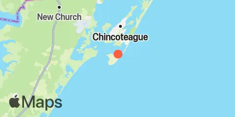
Location & Map
Latitude
37° 51' 54" N (37.865)
Longitude
75° 22' 6" W (-75.3683)
State
County
Nearest ZIP
23336
Nearby
Tides
3.4 mi
Southern Chincoteague Island, Chincoteague Bay
3.5 mi
Chincoteague Channel (South End), Chincoteague Bay
4.7 mi
Chincoteague Island, USCG station
5.1 mi
Chincoteague Island, Lewis Creek
5.4 mi
Chincoteague Island, Oyster Bay
6.0 mi
Chincoteague Island, Blake Cove
6.2 mi
Wallops Island
6.8 mi
Wishart Point, Bogues Bay
8.9 mi
Jesters Island
9.8 mi
Franklin City
12.2 mi
Gargathy Neck
Note: Tide predictions are an estimate and NOT FOR NAVIGATION.
We also offer free widgets if you want to add tide or solunar tables to your own site.