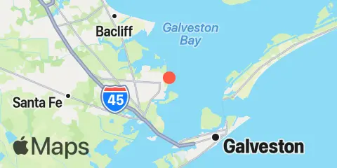
Latitude
29° 23' 26" N (29.3906)
Longitude
94° 53' 6" W (-94.8849)
State
County
Nearest ZIP
77590
Nearby
Tides
0.5 mi
Texas City, Turning Basin, Galveston Bay
6.1 mi
Galveston Railroad Bridge
6.5 mi
Eagle Point, Galveston Bay
6.6 mi
Port Bolivar, Galveston Bay
7.8 mi
Galveston Pier 21, Galveston Channel
9.3 mi
Galveston Pleasure Pier, Gulf Of Mexico
9.9 mi
Galveston Bay Entrance, North Jetty
10.9 mi
Goat Island, Galveston Bay
11.8 mi
Smith Point, Galveston Bay
12.4 mi
Galveston Bay entrance, south jetty
Currents
5.6 mi
Houston Channel, W of Port Bolivar
6.4 mi
Galveston Causeway RR. bridge
6.8 mi
Galveston Channel, west end
7.0 mi
Bolivar Roads
8.0 mi
Galveston Channel, East End
8.1 mi
Houston Ship Channel (Red Fish Bar)
9.3 mi
Galveston Bay Entrance Channel, LB 11
10.7 mi
Galveston Bay Ent. (between jetties)
