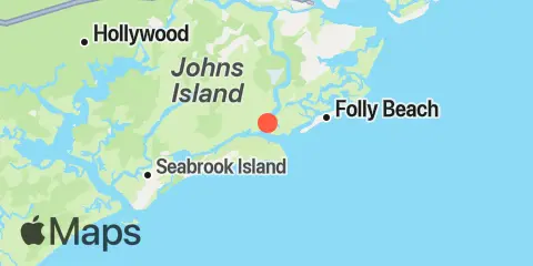
Snake Island Map
Latitude
32° 38' 24" N (32.64)
Longitude
80° 0' 54" W (-80.015)
State
County
Nearest ZIP
29455
Nearby
Tides
2.6 mi
Abbapoola Creek entrance, Stono River
4.3 mi
Folly River Bridge, Folly Island
4.4 mi
Folly Creek, Hwy. 171 bridge
4.8 mi
Folly Island (outer coast)
5.6 mi
Oak Branch, Bohicket Creek, North Edisto River
6.1 mi
Folly River, north, Folly Island
6.8 mi
Church Creek bridge, Wadmalaw River
7.3 mi
Kiawah River Bridge
8.2 mi
James Island Creek, 1 mi. above ent., Ashley River
8.6 mi
Elliott Cut entrance, Stono River
8.9 mi
Ho-Non-Wah Boy Scout Camp, Bohicket Creek, North Edisto River
9.1 mi
Wappoo Creek, highway bridge, Ashley River
9.4 mi
Sandblasters, Pennys Creek, Stono River
9.4 mi
Pennys Creek, west entrance, Stono River
9.5 mi
Johns Island, Church Creek, Wadmalaw River
10.3 mi
Fort Johnson
10.5 mi
South Ashley Bridge, Ashley River
10.9 mi
Rockville, Bohicket Creek, North Edisto River
10.9 mi
Leadenwah Creek, 3 mi. above entrance, North Edisto River
11.1 mi
Charleston, Cooper River Entrance
11.2 mi
Fort Sumter
11.4 mi
Limehouse Bridge, Stono River
11.4 mi
Hollywood, Stono River
Currents
0.3 mi
Snake Island
1.6 mi
Stono Inlet
3.1 mi
Johns Island Airport, south of
7.8 mi
Johns Island Bridge
8.8 mi
Elliott Cut, west end
9.9 mi
Wappoo Creek entrance
10.0 mi
Battery, southwest of
10.3 mi
Pleasant Point
10.3 mi
South Chan., 0.4 mi. NW of Ft. Johnson
10.3 mi
Goshen Point, SE of, Wadmalaw River
10.3 mi
Ashley River Memorial Bridge, Highway 17
10.4 mi
Castle Pinckney, 0.6 mile southwest of
10.4 mi
South Channel, Buoy 4
10.5 mi
Deveaux Banks, off North Edisto River entrance
10.6 mi
Castle Pinckney, 0.4 mile south of
10.9 mi
Shutes Folly Island, 0.4 mile west of
11.0 mi
Trestle Ruins, marker 6A
11.0 mi
Customhouse Reach, off Customhouse
11.1 mi
Folly I. Channel, N of Ft. Johnson
11.2 mi
South Chan., 0.8 mi. ENE of Ft. Johnson
11.2 mi
Goshen Point, south of, Wadmalaw River
11.3 mi
Customhouse Reach
11.4 mi
North Edisto River entrance
11.5 mi
Johns Island. Main Road Bridge
11.5 mi
South Jetty, break in
11.6 mi
Bennis Range, Buoy 34
11.6 mi
Bennis Range, Buoy 31
11.6 mi
Charleston Harbor (off Fort Sumter)
11.7 mi
Horse Reach
11.8 mi
Lower Town Creek Reach
12.0 mi
Drum Island, 0.4 mile SSE of
12.0 mi
Ft. Sumter, 0.6 n.mi. NW of
12.0 mi
Rebellion Reach, 0.8 n.mi. N. of Ft. Sumter
12.1 mi
Fort Sumter Range, Buoy 22
12.1 mi
The Cove, entrance on the Cove Range
12.2 mi
Hog Island Reach, Buoy 38
12.4 mi
Charleston Hbr. ent. (between jetties)
12.4 mi
Town Creek, 0.2 mile above bridge