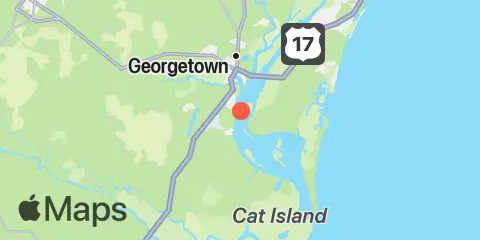
Frazier Point Map
Latitude
33° 19' 0" N (33.31667)
Longitude
79° 16' 60" W (-79.28333)
State
County
Nearest ZIP
29440
Nearby
Tides
3.1 mi
Georgetown, Sampit River
3.8 mi
Waccamaw River entrance, Winyah Bay
4.6 mi
South Island Ferry, Intracoastal Waterway
5.2 mi
Jacobs Wharf, Sampit River
5.3 mi
Clambank Creek Dock, Goat Island, North Inlet
6.1 mi
Crab Haul Creek north inlet estuary, Oyster Landing
7.1 mi
Windsor Plantation, Black River, Great Pee Dee River
7.3 mi
South Island Plantation (C.G. Station), Winyah Bay
8.4 mi
Minim Creek ent., ICWW, North Santee Bay
8.6 mi
Georgetown Lighthouse
9.4 mi
Cumberland, Sampit River
9.4 mi
North Santee Bridge
10.1 mi
Hagley Landing, Waccamaw River
10.6 mi
Weymouth Plantation, Great Pee Dee River
10.8 mi
Ward's Dock, Pawleys Inlet
11.6 mi
U.S. Highway 17 bridge, South Santee River
11.7 mi
Carr Creek, 1 mile above entrance, Great Pee Dee River
11.8 mi
South of Sam Worth Game Management Area, Great Pee Dee River
11.9 mi
Brown Island, South Santee River
12.0 mi
South Santee River, ICWW (Fourmile Creek Canal)
12.0 mi
Winyah Bay Entrance (South Jetty)
12.2 mi
Bennet's Dock, Pawleys Island Creek
12.4 mi
Cedar Island, North Santee Bay
Currents
0.5 mi
Frazier Point, west of
1.6 mi
Rabbit Island, northwest of
1.6 mi
Frazier Point, south of
2.4 mi
Sampit River entrance
2.9 mi
Georgetown, Sampit River
3.9 mi
Pee Dee River, swing bridge
4.0 mi
Lafayette swing bridge, Waccamaw River
6.7 mi
Range D, off Mosquito Creek
8.0 mi
Butler Island, 0.3 mile south of
9.5 mi
Winyah Bay entrance