Carr Creek Weekly Tide Tables and Charts
Tide Chart for Next 7 Days
Carr Creek weekly tide chart key:
The tide chart above shows the times and heights of high tide and low tide for Carr Creek, for the next seven days. The red line highlights the current time and estimated height.The tidal range at Carr Creek for the next seven days is approximately 3.40 ft with a minimum tide of 0.43 ft and maximum tide of 3.83 ft. You can also check out all the daily details on tides & fishing times on the Day tab for Carr Creek.
Tide Table for Next 7 Days
▲ Blue = High Tide
▼ Red = Low Tide
| Day | 1st Tide | 2nd Tide | 3rd Tide | 4th Tide | ☀ Sun |
Major Solunars
|
Minor Solunars
|
|
|---|---|---|---|---|---|---|---|---|
| 30 Wed |
|
▲ 3.51 ft |
▼ 0.43 ft |
▲ 3.49 ft |
▼ 0.85 ft |
▲ 6:28 AM ▼ 8:18 PM |
5:36 AM → 7:36 AM 5:52 PM → 7:52 PM |
12:07 PM → 1:07 PM 11:30 PM → 12:30 AM |
| 31 Thu |
|
▲ 3.33 ft |
▼ 0.56 ft |
▲ 3.49 ft |
▼ 1.01 ft |
▲ 6:29 AM ▼ 8:17 PM |
6:16 AM → 8:16 AM 6:33 PM → 8:33 PM |
1:03 PM → 2:03 PM 11:57 PM → 12:57 AM |
| 1 Fri |
|
▲ 3.17 ft |
▼ 0.65 ft |
▲ 3.5 ft |
▼ 1.1 ft |
▲ 6:30 AM ▼ 8:16 PM |
6:59 AM → 8:59 AM 7:16 PM → 9:16 PM |
2:01 PM → 3:01 PM |
| 2 Sat |
|
▲ 3.06 ft |
▼ 0.71 ft |
▲ 3.54 ft |
▲ 6:30 AM ▼ 8:15 PM |
7:43 AM → 9:43 AM 8:02 PM → 10:02 PM |
12:27 AM → 1:27 AM 2:59 PM → 3:59 PM |
|
| 3 Sun |
|
▼ 1.11 ft |
▲ 2.98 ft |
▼ 0.72 ft |
▲ 3.6 ft |
▲ 6:31 AM ▼ 8:14 PM |
8:29 AM → 10:29 AM 8:53 PM → 10:53 PM |
1:01 AM → 2:01 AM 3:58 PM → 4:58 PM |
| 4 Mon |
|
▼ 1.07 ft |
▲ 2.96 ft |
▼ 0.68 ft |
▲ 3.7 ft |
▲ 6:32 AM ▼ 8:14 PM |
9:19 AM → 11:19 AM 9:45 PM → 11:45 PM |
1:42 AM → 2:42 AM 4:56 PM → 5:56 PM |
| 5 Tue |
|
▼ 0.96 ft |
▲ 2.99 ft |
▼ 0.58 ft |
▲ 3.83 ft |
▲ 6:32 AM ▼ 8:13 PM |
10:11 AM → 12:11 PM 10:40 PM → 12:40 AM |
2:31 AM → 3:31 AM 5:51 PM → 6:51 PM |
Buoy Weather
Air Temperature
81.9° F
Wind
2.9 knots SE (130°)
Atmospheric Pressure
29.97 in
Note: Observations are from a weather buoy 8.02 miles from the prediction site. Observations are not available at all prediction sites, and observation types vary between sites.
More details: Station niws1 Buoy Weather
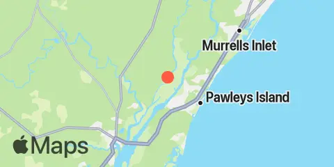
Location & Map
Latitude
33° 27' 54" N (33.465)
Longitude
79° 11' 12" W (-79.1867)
State
County
Nearest ZIP
29440
Nearby
Tides
0.2 mi
South of Sam Worth Game Management Area, Great Pee Dee River
1.3 mi
Weymouth Plantation, Great Pee Dee River
1.4 mi
Arundel Plantation, Great Pee Dee River
2.1 mi
Hagley Landing, Waccamaw River
3.8 mi
Thoroughfare Creek entrance, Waccamaw River
4.0 mi
Bennet's Dock, Pawleys Island Creek
4.5 mi
Midway Inlet North, Pawleys Island
4.6 mi
Pawleys Island Pier (Ocean)
4.7 mi
Ward's Dock, Pawleys Inlet
4.9 mi
Litchfield Beach bridge
5.0 mi
Windsor Plantation, Black River, Great Pee Dee River
6.0 mi
Holly Grove Plantation, Great Pee Dee River
7.6 mi
Oaks Creek, upper end, Murrells Inlet
7.8 mi
Crab Haul Creek north inlet estuary, Oyster Landing
7.9 mi
Waccamaw River entrance, Winyah Bay
8.9 mi
Wachesaw Landing, Waccamaw River
8.9 mi
Georgetown, Sampit River
9.0 mi
Allston Creek, Murrells Inlet
9.1 mi
Clambank Creek Dock, Goat Island, North Inlet
9.4 mi
Oaks Creek, 0.5 mi. above entrance, Murrells Inlet
9.5 mi
Black River (south of Dunbar), Great Pee Dee River
9.9 mi
Smith's Dock, Murrells Inlet
10.1 mi
Lower Topsaw Landing, Great Pee Dee River
10.2 mi
Little Bull Creek entrance, Bull Creek, Waccamaw River
10.4 mi
Bull Creek entrance, Waccamaw River
10.5 mi
Captain Alex's Marina, Parsonage Creek, Murrells Inlet
10.6 mi
Divine's Dock, Murrells Inlet
11.7 mi
Frazier Point
12.0 mi
Jacobs Wharf, Sampit River
Currents
3.6 mi
Butler Island, 0.3 mile south of
7.7 mi
Lafayette swing bridge, Waccamaw River
7.9 mi
Pee Dee River, swing bridge
9.3 mi
Georgetown, Sampit River
9.5 mi
Sampit River entrance
10.3 mi
Rabbit Island, northwest of
12.2 mi
Frazier Point, west of
Note: Tide predictions are an estimate and NOT FOR NAVIGATION.
We also offer free widgets if you want to add tide or solunar tables to your own site.