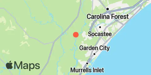
Latitude
33° 38' 48" N (33.6467)
Longitude
79° 5' 42" W (-79.095)
State
County
Nearest ZIP
29527
Nearby
Tides
2.3 mi
Enterprise Landing, Waccamaw River
3.4 mi
Little Bull Creek entrance, Bull Creek, Waccamaw River
3.5 mi
Bull Creek entrance, Waccamaw River
3.6 mi
Yauhannah Bridge, Great Pee Dee River
4.2 mi
Lower Topsaw Landing, Great Pee Dee River
5.9 mi
Wachesaw Landing, Waccamaw River
5.9 mi
Socastee Bridge
7.0 mi
Keysfield, Waccamaw River
7.1 mi
Garden City Bridge, Main Creek, Murrells Inlet
7.4 mi
Captain Alex's Marina, Parsonage Creek, Murrells Inlet
7.5 mi
Garden City Pier (Ocean)
7.6 mi
Smith's Dock, Murrells Inlet
7.8 mi
Surfside Beach
8.1 mi
Holly Grove Plantation, Great Pee Dee River
8.2 mi
Divine's Dock, Murrells Inlet
8.3 mi
Allston Creek, Murrells Inlet
8.6 mi
Oaks Creek, 0.5 mi. above entrance, Murrells Inlet
9.5 mi
Oaks Creek, upper end, Murrells Inlet
10.1 mi
Thoroughfare Creek entrance, Waccamaw River
10.2 mi
Springmaid Pier
10.8 mi
Pitch Landing, Waccamaw River
11.0 mi
Myrtle Beach, Combination Bridge
12.1 mi
Litchfield Beach bridge
12.3 mi
Arundel Plantation, Great Pee Dee River
