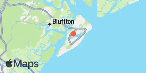
Broad Creek Map
Latitude
32° 11' 6" N (32.185)
Longitude
80° 45' 12" W (-80.7533)
State
County
Nearest ZIP
29926
Nearby
Tides
2.9 mi
Skull Creek, south entrance, Hilton Head Island
3.3 mi
Calibogue Cay, Broad Creek, Hilton Head Island
3.8 mi
Bull Island North, May River
5.2 mi
Pinckney Island, Mackay Creek, Chechessee River
5.5 mi
Port Royal Plantation, Hilton Head Island
5.6 mi
Haig Point, Daufuskie Island, Cooper River
5.7 mi
Skull Creek, Ribaut Island
5.8 mi
Brighton Beach, May River
6.2 mi
Bull Creek, Bull Island South, Cooper River
6.2 mi
Savage I., Savage Creek, Bull Creek
6.7 mi
Braddock Point, Hilton Head Island
7.1 mi
Bluffton, May River
8.1 mi
Moreland Cemetery, May River
9.4 mi
Station Creek, west end
9.6 mi
Pine Island, Ramshorn Creek, Cooper River
9.7 mi
Colleton River Entrance
10.0 mi
Daufuskie Landing, Daufuskie Island, New River
10.2 mi
Bloody Point, Daufuskie Island, New River
10.4 mi
Hargray Pier, Daufuskie Island, New River
10.5 mi
Callawassie Creek, Colleton River
10.5 mi
Fort Fremont, Beaufort River
10.8 mi
Callawassie Island, south, Colleton River
10.9 mi
Doughboy Island, New River
11.6 mi
Capers Island, Trenchards Inlet
12.4 mi
Tybee Light, Savannah River
12.4 mi
Callawassie Island Bridge, Colleton River
Currents
1.9 mi
Spanish Wells, Calibogue Sound
3.2 mi
Skull Creek, south entrance
3.2 mi
MacKay Creek, south entrance
5.5 mi
Skull Creek, north entrance
5.8 mi
Haig Point Light, NW of, Cooper River
6.2 mi
Port Royal Plantation Tower, east of
6.8 mi
Hilton Head
7.1 mi
Daws Island, south of, Chechessee River
7.4 mi
Broad River Entrance, Point Royal Sound
7.4 mi
Braddock Point, SW of, Calibogue Sound
8.0 mi
Bay Point Island, S of, Broad River entrance
8.2 mi
Daws Island, SE of, Broad River
8.4 mi
Ramshorn Creek Light, E of, Cooper River
9.2 mi
Parris Island Lookout Tower, Broad River
9.3 mi
Beaufort River Entrance
10.0 mi
Bloody Pt., 0.5 mile north of, New River
10.3 mi
Daufuskie Landing Light, south of
10.4 mi
Bloody Pt., 0.5 mile west of, New River
10.6 mi
Southeast Channel, Buoy 8
11.3 mi
Parris Island, east of, Beaufort River
11.8 mi
Lemon Island South, Chechessee River
11.9 mi
Walls Cut, Turtle Island
12.0 mi
Wright R., 0.2 mile above Walls Cut