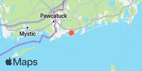
Latitude
41° 19' 42" N (41.3283)
Longitude
71° 45' 42" W (-71.7617)
State
County
Nearest ZIP
02891
Nearby
Tides
5.2 mi
Westerly, Pawcatuck River
5.4 mi
Watch Hill Point
11.1 mi
West Mystic, Mystic River, Long Island Sound
Currents
2.7 mi
Quonochontaug Beach, 1.1 miles S of
3.1 mi
Watch Hill Point, 2.2 miles east of
4.5 mi
Quonochontaug Beach, 3.8 miles S of
5.9 mi
Watch Hill Point, 5.3 n.mi. SE of
6.3 mi
Little Narragansett Bay entrance
7.1 mi
Sandy Point, 4.1 miles northwest of
7.5 mi
Napatree Point, 0.7 mile southwest of
7.5 mi
Wicopesset island, NE of
8.0 mi
Watch Hill Point, 5.2 miles SSE of
8.7 mi
Green Hill Point, 1.1 miles south of
9.4 mi
Lewis Point, 6.0 miles WNW of
11.1 mi
Sandy Point, 2.1 miles NNE of
11.2 mi
East Pt., 4.1 miles S of Fishers Island
11.2 mi
Ram Island Reef, south of
11.3 mi
Clay Point, 1.3 miles NNE of
11.5 mi
Sandy Pt., 1.5 miles north of
12.0 mi
4 miles north of
12.1 mi
Montauk Point, 5.4 miles NNE of
12.2 mi
Great Salt Pond ent., 1 mile NW of
