Quonset Point Weekly Tide Tables and Charts
Tide Chart for Next 7 Days
Quonset Point weekly tide chart key:
The tide chart above shows the times and heights of high tide and low tide for Quonset Point, for the next seven days. The red line highlights the current time and estimated height.The tidal range at Quonset Point for the next seven days is approximately 4.76 ft with a minimum tide of -0.14 ft and maximum tide of 4.62 ft. You can also check out all the daily details on tides & fishing times on the Day tab for Quonset Point.
Tide Table for Next 7 Days
▲ Blue = High Tide
▼ Red = Low Tide
| Day | 1st Tide | 2nd Tide | 3rd Tide | 4th Tide | ☀ Sun |
Major Solunars
|
Minor Solunars
|
|
|---|---|---|---|---|---|---|---|---|
| 10 Sun |
|
▼ 0.1 ft |
▲ 4.27 ft |
▼ 0.1 ft |
▲ 4.62 ft |
▲ 5:50 AM ▼ 7:52 PM |
1:38 AM → 3:38 AM 1:55 PM → 3:55 PM |
7:04 AM → 8:04 AM 8:46 PM → 9:46 PM |
| 11 Mon |
|
▼ -0.04 ft |
▲ 4.45 ft |
▼ 0.09 ft |
▲ 4.55 ft |
▲ 5:51 AM ▼ 7:50 PM |
2:26 AM → 4:26 AM 2:42 PM → 4:42 PM |
8:17 AM → 9:17 AM 9:08 PM → 10:08 PM |
| 12 Tue |
|
▼ -0.13 ft |
▲ 4.56 ft |
▼ 0.16 ft |
▲ 4.38 ft |
▲ 5:52 AM ▼ 7:49 PM |
3:13 AM → 5:13 AM 3:29 PM → 5:29 PM |
9:29 AM → 10:29 AM 9:30 PM → 10:30 PM |
| 13 Wed |
|
▼ -0.14 ft |
▲ 4.6 ft |
▼ 0.3 ft |
▲ 5:53 AM ▼ 7:48 PM |
4:00 AM → 6:00 AM 4:18 PM → 6:18 PM |
10:43 AM → 11:43 AM 9:54 PM → 10:54 PM |
|
| 14 Thu |
|
▲ 4.17 ft |
▼ -0.07 ft |
▲ 4.58 ft |
▼ 0.51 ft |
▲ 5:54 AM ▼ 7:46 PM |
4:50 AM → 6:50 AM 5:09 PM → 7:09 PM |
11:58 AM → 12:58 PM 10:21 PM → 11:21 PM |
| 15 Fri |
|
▲ 3.94 ft |
▼ 0.08 ft |
▲ 4.5 ft |
▼ 0.74 ft |
▲ 5:55 AM ▼ 7:45 PM |
5:42 AM → 7:42 AM 6:04 PM → 8:04 PM |
1:15 PM → 2:15 PM 10:54 PM → 11:54 PM |
| 16 Sat |
|
▲ 3.75 ft |
▼ 0.3 ft |
▲ 4.4 ft |
▼ 0.9 ft |
▲ 5:56 AM ▼ 7:43 PM |
6:38 AM → 8:38 AM 7:02 PM → 9:02 PM |
2:31 PM → 3:31 PM 11:34 PM → 12:34 AM |
Buoy Weather
Air Temperature
67.3° F
Water Temperature
70.5° F
Wind
6 knots WSW (250°)
Wind Gust
7 knots
Atmospheric Pressure
30.23 in
Note: Observations are from a weather buoy 0.21 miles from the prediction site. Observations are not available at all prediction sites, and observation types vary between sites.
More details: Station qptr1 Buoy Weather
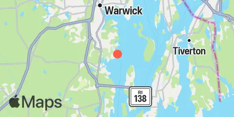
Location & Map
Latitude
41° 35' 12" N (41.5868)
Longitude
71° 24' 40" W (-71.411)
State
County
Nearest ZIP
02852
Nearby
Tides
2.0 mi
Wickford, Narragansett Bay
2.2 mi
Conanicut Point, Conanicut Island
4.6 mi
Prudence Island, (South End), Narragansett Bay
5.7 mi
East Greenwich, Narragansett Bay
6.4 mi
West Jamestown, Dutch Island Harbor, Conanicut Island
7.1 mi
Newport, Narragansett Bay
8.8 mi
Bristol Ferry, Narragansett Bay
8.8 mi
Bristol, Bristol Harbor, Narragansett Bay
8.8 mi
Watson Pier, Boston Neck, Narragansett Bay
8.9 mi
Castle Hill, Narragansett Bay
9.2 mi
The Glen, Sakonnet River
9.4 mi
Beavertail Point, Conanicut Island
9.6 mi
Conimicut Light, Narragansett Bay
9.7 mi
Bristol Highlands, Narragansett Bay
10.9 mi
Anthony Point, Sakonnet River
11.0 mi
Nannaquaket Neck, Sakonnet River
11.3 mi
Sachuest, Flint Point, Sakonnet River
11.3 mi
North End, Bay Oil pier, Sakonnet River
11.6 mi
Narragansett Pier, Narragansett Bay
11.8 mi
Bay Spring, Bullock Cove, Narragansett Bay
12.1 mi
Kickamuit River, Narragansett Bay
12.2 mi
Pawtuxet, Pawtuxet Cove, Narragansett Bay
Currents
0.8 mi
Quonset Point
3.7 mi
Conanicut Point, ENE of
4.7 mi
Gould Island, west of
5.3 mi
Dyer Island, west of
5.6 mi
Patience I. and Warwick Neck, between
5.7 mi
Dutch Island, west of
5.7 mi
Gould Island, southeast of
5.8 mi
Patience Island, narrows east of
6.0 mi
Dyer Island-Carrs Point (between)
6.2 mi
Dutch Island and Beaver Head, between
6.3 mi
Rose Island, northwest of
7.0 mi
Rose Island, west of
7.1 mi
Rose Island, northeast of
7.3 mi
Hog Island, northwest of
8.0 mi
Bull Point, east of
8.7 mi
Mount Hope Bridge
8.9 mi
Beavertail Point, 0.8 mile northwest of
9.2 mi
Castle Hill, west of, East Passage
9.6 mi
Common Fence Point, west of
10.1 mi
Nayatt Point, WNW of
10.2 mi
Almy Point Bridge, south of, Sakonnet River
10.9 mi
Brenton Point, 1.4 n.mi. southwest of
11.3 mi
Black Point, SW of, Sakonnet River
11.7 mi
Warren, Warren River
12.2 mi
Mount Hope Point, northeast of
Note: Tide predictions are an estimate and NOT FOR NAVIGATION.
We also offer free widgets if you want to add tide or solunar tables to your own site.