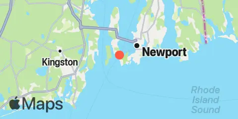
Latitude
41° 27' 48" N (41.4633)
Longitude
71° 21' 42" W (-71.3617)
State
County
Nearest ZIP
02840
Nearby
Tides
2.2 mi
Beavertail Point, Conanicut Island
2.6 mi
West Jamestown, Dutch Island Harbor, Conanicut Island
3.4 mi
Newport, Narragansett Bay
3.5 mi
Watson Pier, Boston Neck, Narragansett Bay
5.6 mi
Narragansett Pier, Narragansett Bay
6.6 mi
Sachuest, Flint Point, Sakonnet River
7.6 mi
Conanicut Point, Conanicut Island
8.3 mi
Prudence Island, (South End), Narragansett Bay
8.6 mi
Wickford, Narragansett Bay
8.7 mi
Sakonnet, Sakonnet River
8.9 mi
Quonset Point
9.2 mi
The Glen, Sakonnet River
9.6 mi
Point Judith, Harbor of Refuge
Currents
1.0 mi
Castle Hill, west of, East Passage
1.3 mi
Bull Point, east of
2.3 mi
Brenton Point, 1.4 n.mi. southwest of
2.4 mi
Rose Island, west of
2.6 mi
Beavertail Point, 0.8 mile northwest of
3.0 mi
Rose Island, northwest of
3.2 mi
Dutch Island and Beaver Head, between
3.2 mi
Rose Island, northeast of
3.8 mi
Dutch Island, west of
4.5 mi
Gould Island, southeast of
4.7 mi
Gould Island, west of
7.8 mi
Conanicut Point, ENE of
7.9 mi
Black Point, SW of, Sakonnet River
8.4 mi
Dyer Island-Carrs Point (between)
8.5 mi
Quonset Point
9.0 mi
Dyer Island, west of
9.8 mi
Pond entrance - Point Judith
10.1 mi
Harbor of Refuge, south entrance
12.0 mi
2.4 miles southwest of
