TidesPro
  • Recents
    • Beavertail Point, Conanicut Island
  • Tides
    United States
    Alabama Alaska California Connecticut Delaware District of Columbia Florida Georgia Hawaii
    Louisiana Maine Maryland Massachusetts Mississippi New Hampshire New Jersey New York North Carolina
    Oregon Pennsylvania Rhode Island South Carolina Texas US Outlying Islands Virginia Washington Puerto Rico
    Caribbean
    The Bahamas Cayman Islands Cuba Dominican Republic Haiti Jamaica Virgin Islands (US)
  • Fishing  Coordinates
    Alabama - Alabama Inshore Public Reefs Alabama - Alabama Nearshore Public Reefs Alabama - Alabama Offshore Public Reefs California - California Artificial Reefs Delaware - Delaware Artificial Reefs Florida - Bay County Florida - Brevard County Florida - Broward County Florida - Charlote and Lee Counties Florida - Citrus County Florida - Collier County Florida - Dixie County Florida - Duval County Florida - Escambia County Florida - Flagler County Florida - Florida Keys Florida - Franklin County Florida - Gulf County Florida - Hernando County
    Florida - Indian River County Florida - Levy County Florida - Manatee County Florida - Martin County Florida - Miami-Dade County Florida - Monroe County Florida - Nassau County Florida - Okaloosa County Florida - Palm Beach County Florida - Pasco County Florida - Santa Rosa County Florida - Sarasota County Florida - St. Johns County Florida - St. Lucie County Florida - Tampa Bay Florida - Taylor County Florida - Volusia County Florida - Wakulla County Florida - Walton County
    Georgia - Georgia Reefs Hawaii - Hawaii Artificial Reefs Louisiana - Louisiana Artificial Reefs Maryland - Maryland Artificial Reefs Massachusetts - Massachusetts Artificial Reefs Mississippi - Mississippi Inshore Artificial Reefs Mississippi - Mississippi Offshore Artificial Reefs New Jersey - New Jersey Artificial Reefs New York - New York Artificial Reefs North Carolina - Estuarine North Carolina - Long Bay North Carolina - Onslow Bay North Carolina - Outer Banks North Carolina - Raleigh Bay Puerto Rico - Puerto Rico Artificial Reefs Rhode Island - Rhode Island Artificial Reefs South Carolina - South Carolina Reefs Texas - Texas Artificial Reefs Virginia - Virginia Artificial Reefs
  • Solunar Tables
Beavertail Point Location
  1. United States
  2. Rhode Island
  3. Beavertail Point, Conanicut Island

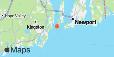
Beavertail Point Map

Day Week Month Table Month Chart Map
Latitude
41° 27' 6" N (41.4517)
Longitude
71° 24' 6" W (-71.4017)
State
Rhode Island
County
Newport County
Nearest ZIP
02835
Nearby
Tides 1.5 mi Watson Pier, Boston Neck, Narragansett Bay 2.2 mi Castle Hill, Narragansett Bay 3.2 mi West Jamestown, Dutch Island Harbor, Conanicut Island 3.5 mi Narragansett Pier, Narragansett Bay 5.4 mi Newport, Narragansett Bay 7.6 mi Point Judith, Harbor of Refuge 8.6 mi Conanicut Point, Conanicut Island 8.6 mi Wickford, Narragansett Bay 8.8 mi Sachuest, Flint Point, Sakonnet River 9.4 mi Quonset Point 9.8 mi Prudence Island, (South End), Narragansett Bay 10.8 mi Sakonnet, Sakonnet River 11.3 mi The Glen, Sakonnet River Currents 0.7 mi Beavertail Point, 0.8 mile northwest of 1.3 mi Castle Hill, west of, East Passage 1.9 mi Brenton Point, 1.4 n.mi. southwest of 3.1 mi Dutch Island and Beaver Head, between 3.3 mi Bull Point, east of 3.7 mi Dutch Island, west of 4.1 mi Rose Island, west of 4.6 mi Rose Island, northwest of 5.1 mi Rose Island, northeast of 6.0 mi Gould Island, west of 6.1 mi Gould Island, southeast of 7.6 mi Pond entrance - Point Judith 8.1 mi Harbor of Refuge, south entrance 9.1 mi Conanicut Point, ENE of 9.1 mi Quonset Point 10.1 mi 2.4 miles southwest of 10.1 mi Dyer Island-Carrs Point (between) 10.2 mi Black Point, SW of, Sakonnet River 10.5 mi Dyer Island, west of 12.4 mi Green Hill Point, 1.1 miles south of

About

TidesPro was created as an easy-to-use tides and solunar site. It provides tide predictions and marine weather for many types of people, whether you’re fishing, going to the beach, boating, kayaking, surfing, or planning a trip. With anglers in mind, it also provides an accessible way to find fishing spots and the best times to fish in those locations.

More About TidesPro

App

Apple App Store
[More Info]
Quick Links
  • When to Fish
  • Solunar Theory
  • Tide & Solunar Widgets for Your Site
  • Tide & Solunar Predictions in Google Earth
  • Things to Do
  • About

© Copyright 2017 - 2025 ASR Concepts LLC. All rights reserved.

  • Privacy Policy
  • •
  • Terms of Use
  • •
  • Contact
  • •
  • Bluesky
  • •
  • Mastodon