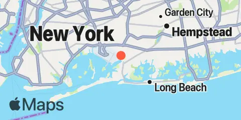
Latitude
40° 38' 6" N (40.635)
Longitude
73° 44' 48" W (-73.7467)
State
County
Nearest ZIP
11422
Nearby
Tides
1.4 mi
Motts Basin, Jamaica Bay
2.1 mi
J.F.K. International Airport, Jamaica Bay
2.7 mi
Woodmere, Brosewere Bay, Hempstead Bay
2.8 mi
Atlantic Beach, East Rockaway Inlet, Long Island
4.0 mi
Bay Park, East Rockaway, Hewlett Bay
4.8 mi
North Channel Bridge, Grassy Bay, Jamaica Bay
5.0 mi
Beach Channel (Bridge), Jamaica Bay
5.5 mi
Long Beach (Bridgeview Yacht Club)
5.6 mi
Long Beach (Inside), Hempstead Bay
6.8 mi
Parsonnage Cove, Long Island
7.3 mi
Canarsie, Jamaica Bay
8.4 mi
Freeport, Baldwin Bay, Hempstead Bay
8.4 mi
Barren Island, Rockaway Inlet, Jamaica Bay
9.0 mi
Point Lookout, Long Island
9.4 mi
Mill Basin, Jamaica Bay
9.5 mi
Jones Inlet (Point Lookout), Long Island
10.0 mi
Plumb Beach Channel, Jamaica Bay
10.1 mi
Neds Creek, Hempstead Bay
10.5 mi
Kingsborough Community College, Sheepshead Bay, Long Island
11.1 mi
Willets Point, Little Bay, East River
11.8 mi
College Pt, Ft. of 110th Street, Long Island
11.8 mi
Cuba Island, Hempstead Bay
11.8 mi
Whitestone, East River
11.8 mi
Deep Creek Meadow, Hempstead Bay
12.0 mi
Throgs Neck
12.1 mi
Bellmore, Bellmore Creek, Hempstead Bay
12.2 mi
Kings Point, Long Island Sound
Currents
2.7 mi
Grass Hassock Channel
3.1 mi
East Rockaway Inlet
5.1 mi
Beach Channel (bridge)
5.3 mi
Long Beach, inside, between bridges
7.1 mi
Canarsie (midchannel), Jamaica Bay
8.4 mi
Marine Parkway Bridge, Rockaway Inlet
9.9 mi
Jones Inlet
11.2 mi
Rockaway Inlet Entrance
11.5 mi
Throgs Neck, 0.4 mile south of
11.7 mi
Throgs Neck Bridge
11.8 mi
Cryders Point, 0.4 mile NNW of
11.8 mi
Throgs Neck, 0.2 mile S of (Willets Point)
12.3 mi
Bronx-Whitestone Bridge, East of
12.3 mi
Rockaway Point
12.3 mi
Throgs Neck, 0.3 n.mi. NE of
