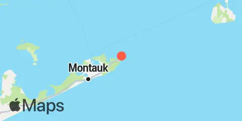
Unfortunately, this tide station is no longer active, and predictions are no longer accurate.
You can check out the map below -- any nearby locations will be displayed on the map and list below. Alternatively, you can browse the site for other active locations.
Location & Map
Latitude
41° 4' 18" N (41.0717)
Longitude
71° 51' 24" W (-71.8567)
State
County
Nearest ZIP
11954
Nearby
Tides
4.1 mi
Lake Montauk, Long Island
4.2 mi
Montauk Harbor entrance, Long Island
5.6 mi
Montauk, Fort Pond Bay, Long Island Sound
Currents
0.9 mi
Montauk Point, 1 mile northeast of
1.4 mi
Montauk Point, 1.2 miles east of
5.5 mi
Shagwong Reef & Cerberus Shoal, between
6.3 mi
Montauk Point, 5.4 miles NNE of
7.8 mi
Cerberus Shoal, 1.5 miles east of
7.8 mi
Southwest Ledge, 2.0 miles west of
8.0 mi
Eastern Plain Pt., 3.9 miles ENE of
8.7 mi
Southwest Ledge
9.1 mi
Rocky Point, 2 miles WNW of
10.1 mi
Gardiners Island, 3 miles northeast of
10.5 mi
Watch Hill Point, 5.2 miles SSE of
10.5 mi
Lewis Point, 6.0 miles WNW of
11.1 mi
East Pt., 4.1 miles S of Fishers Island
11.2 mi
Goff Point, 0.4 mile northwest of
11.5 mi
Cerberus Shoal and Fishers I., between
