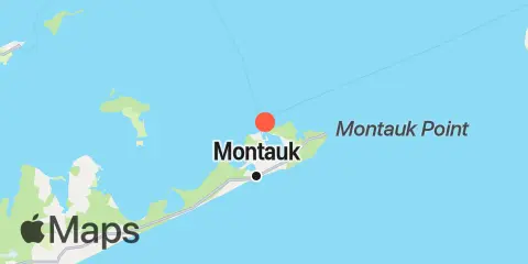
Latitude
41° 4' 30" N (41.075)
Longitude
71° 56' 12" W (-71.9367)
State
County
Nearest ZIP
11954
Nearby
Tides
0.1 mi
Lake Montauk, Long Island
2.2 mi
Montauk, Fort Pond Bay, Long Island Sound
Currents
4.0 mi
Shagwong Reef & Cerberus Shoal, between
4.3 mi
Eastern Plain Pt., 3.9 miles ENE of
4.6 mi
Montauk Point, 1 mile northeast of
5.0 mi
Rocky Point, 2 miles WNW of
5.6 mi
Montauk Point, 1.2 miles east of
6.4 mi
Gardiners Island, 3 miles northeast of
6.9 mi
Cerberus Shoal, 1.5 miles east of
7.4 mi
Goff Point, 0.4 mile northwest of
8.2 mi
Montauk Point, 5.4 miles NNE of
9.9 mi
Cerberus Shoal and Fishers I., between
10.3 mi
East Pt., 4.1 miles S of Fishers Island
10.4 mi
Acabonack Hbr. ent., 0.6 mile ESE of
11.7 mi
Hog Creek Point, north of
11.8 mi
Southwest Ledge, 2.0 miles west of
11.8 mi
Watch Hill Point, 5.2 miles SSE of
12.2 mi
Mt. Prospect, 0.6 mile SSE of
12.4 mi
Gardiners Pt. Ruins, 1.1 miles N of
