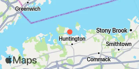
Huntington Harbor Lighthouse Map
Latitude
40° 54' 36" N (40.91)
Longitude
73° 25' 54" W (-73.4317)
State
County
Nearest ZIP
11743
Nearby
Tides
3.2 mi
Cold Spring Harbor, Oyster Bay
3.4 mi
Eatons Neck Point, Long Island
4.2 mi
Northport, Northport Bay, Long Island
5.4 mi
Oyster Bay Harbor, Oyster Bay
6.2 mi
Bayville Bridge, Oyster Bay
9.2 mi
Long Neck Point, Long Island Sound
10.7 mi
Stamford Harbor, Stamford
10.7 mi
Rowayton, Fivemile River
11.3 mi
Cos Cob Harbor
12.1 mi
Glen Cove Yacht Club, Hempstead Harbor, Long Island
Currents
1.3 mi
Northport Bay entrance (in channel)
1.4 mi
Huntington Bay, off East Fort Point
2.6 mi
Northport Bay, south of Duck I. Bluff
2.8 mi
Eatons Neck Pt., 1.8 miles west of
3.7 mi
Rocky Point, 1 mile east of
4.5 mi
Harbor ent., south of Plum Point
5.0 mi
Eatons Neck Pt., 1.3 miles north of
5.1 mi
Lloyd Point, 1.3 miles NNW of
5.6 mi
Harbor, west of Soper Point
5.7 mi
Eatons Neck, 2.5 miles east of
6.0 mi
Eatons Neck Pt., 2.5 n.mi. NNW of
6.4 mi
The Cows, 2 miles SE of
6.7 mi
Eatons Neck, 3 miles north of
7.1 mi
Oak Neck Point, 0.6 mile north of
7.6 mi
Greenwich Point, 2.5 miles south of
7.6 mi
Shippan Point, 1.3 miles SSE of
8.4 mi
Long Neck Point, 0.6 mile south of
8.6 mi
Sheffield I. Tower, 1.1 miles SE of
8.7 mi
Greenwich Point, 1.1 miles south of
9.1 mi
Stamford Harbor entrance
10.1 mi
Sheffield I. Hbr., 0.5 mile southeast of
10.3 mi
Captain Hbr. Ent., 0.6 mile southwest of
10.7 mi
Crane Neck Point, 3.7 miles WSW of
10.9 mi
Matinecock Point, 0.7 mile NNW of
11.5 mi
Cos Cob Harbor, off Goose Island
11.6 mi
Crane Neck Point, 3.4 miles WNW of
11.8 mi
Matinecock Point, 1.7 miles northwest of
12.0 mi
Parsonage Point, 1.3 n.mi. ESE of
12.2 mi
Norwalk Harbor