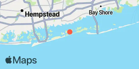
Latitude
40° 37' 12" N (40.62)
Longitude
73° 23' 42" W (-73.395)
State
County
Nearest ZIP
11704
Nearby
Tides
2.7 mi
Amityville, Great South Bay
5.0 mi
Biltmore Shores, South Oyster Bay, Long Island
5.4 mi
Democrat Point, Fire Island Inlet, Long Island
5.4 mi
Oak Beach, Great South Bay
5.6 mi
Green Island, Hempstead Bay
6.1 mi
Babylon, Great South Bay
6.7 mi
Cuba Island, Hempstead Bay
6.9 mi
Deep Creek Meadow, Hempstead Bay
7.1 mi
Fire Island Coast Guard Station, Great South Bay
7.2 mi
Bellmore, Bellmore Creek, Hempstead Bay
8.4 mi
Neds Creek, Hempstead Bay
9.2 mi
Fire Island Light, Great South Bay
9.9 mi
Jones Inlet (Point Lookout), Long Island
10.1 mi
Point Lookout, Long Island
10.1 mi
Freeport, Baldwin Bay, Hempstead Bay
10.3 mi
West Fire Island, Great South Bay
10.5 mi
Bay Shore, Watchogue Creek Entrance, Great South Bay
11.7 mi
Parsonnage Cove, Long Island
Currents
4.7 mi
Fire I. Inlet, 0.5 mi. S of Oak Beach
9.2 mi
Jones Inlet
