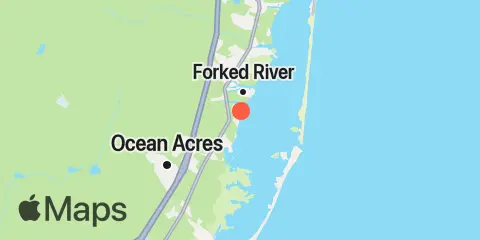
Latitude
39° 47' 30" N (39.7917)
Longitude
74° 10' 54" W (-74.1817)
State
County
Nearest ZIP
08758
Nearby
Tides
1.2 mi
Oyster Creek, Barnegat Bay
2.3 mi
Forked River, Barnegat Bay
3.4 mi
Double Creek, Barnegat Bay
3.7 mi
High Bar, Barnegat Bay
4.0 mi
Stouts Creek, Barnegat Bay
4.3 mi
Barnegat Inlet, USCG Station, Barnegat Bay
4.4 mi
Island Beach, Sedge Islands, Barnegat Bay
5.2 mi
Loveladies Harbor, Barnegat Bay
5.6 mi
Cedar Creek, Barnegat Bay
5.9 mi
Flat Creek, Manahawkin Bay
6.5 mi
Island Beach, Barnegat Bay
8.2 mi
North Beach, Manahawkin Bay
8.2 mi
Sloop Creek, Barnegat Bay
8.8 mi
Manahawkin Creek, Manahawkin Bay
9.2 mi
Mill Creek, 1 n.mi. above entrance, Little Egg Harbor
9.5 mi
Barnegat Pier, Barnegat Bay
9.6 mi
Manahawkin Drawbridge, Manahawkin Bay
10.4 mi
Cedar Run, Little Egg Harbor
10.4 mi
Seaside Park, Barnegat Bay
10.5 mi
Dinner Point Creek, upper end, Little Egg Harbor
11.0 mi
Toms River (town), Toms River, Barnegat Bay
11.4 mi
Coates Point, Barnegat Bay
12.4 mi
Goose Creek entrance, Barnegat Bay
Currents
3.9 mi
Barnegat Inlet
9.8 mi
Manahawkin Drawbridge
