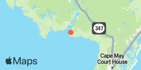
Latitude
39° 12' 0" N (39.2)
Longitude
75° 1' 12" W (-75.02)
State
County
Nearest ZIP
08324
Nearby
Tides
2.3 mi
Bivalve, Maurice River, Delaware Bay
2.5 mi
Riggins Ditch, Heislerville, Delaware Bay
2.7 mi
Riggins Ditch, 0.5 n.mi. above entrance, Delaware Bay
4.6 mi
Dividing Creek entrance, Delaware Bay
5.2 mi
West Creek, Route 47 bridge, Delaware Bay
5.7 mi
West Creek, 0.7 n.mi. above entrance, Delaware Bay
6.1 mi
Mauricetown, Maurice River
6.4 mi
East Creek, Route 47 bridge, Delaware Bay
6.8 mi
Weir Creek bridge, Dividing Creek, Delaware Bay
7.5 mi
Fishing Creek entrance, Delaware Bay
8.1 mi
Port Elizabeth, Manumuskin River, Maurice River
8.3 mi
Hollywood Beach, The Glades, Delaware Bay
8.5 mi
Bidwell Creek entrance, Delaware Bay
8.7 mi
Fortescue Creek
9.1 mi
Dennis Creek, 2.5 n.mi. above entrance, Delaware Bay
9.9 mi
Bidwell Creek, Route 47 bridge, Delaware Bay
9.9 mi
Menantico Creek entrance, Maurice River
10.4 mi
Sluice Creek, Route 47 bridge, Dennis Creek, Delaware Bay
10.7 mi
Dennis Creek, Route 47 bridge, Delaware Bay
10.8 mi
Dias Creek, Route 47 bridge, Delaware Bay
11.5 mi
Newport Landing, Nantuxent Creek, Delaware Bay
Currents
1.8 mi
Maurice River entrance
6.2 mi
Mauricetown Bridge, Maurice River
8.3 mi
Egg Island Flats
8.7 mi
Bay Shore Channel (north)
9.6 mi
Deadman Shoal, 3.1 n.mi. SW of
9.7 mi
False Egg Island Point, 2 miles off
12.0 mi
Brandywine Range at Miah Maull Range
