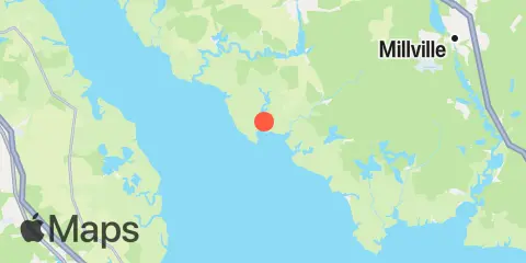
Latitude
39° 18' 18" N (39.305)
Longitude
75° 16' 42" W (-75.2783)
State
County
Nearest ZIP
08311
Nearby
Tides
1.8 mi
Cedar Creek entrance, Nantuxent Cove, Delaware Bay
2.5 mi
Money Island, Nantuxent Creek entrance, Delaware Bay
4.4 mi
Newport Landing, Nantuxent Creek, Delaware Bay
5.2 mi
Ship John Shoal, Delaware River
5.6 mi
Tindalls Wharf, Cohansey River, Delaware Bay
6.6 mi
Greenwich Pier, Cohansey River, Delaware Bay
7.2 mi
Fortescue Creek
7.6 mi
Hollywood Beach, The Glades, Delaware Bay
8.9 mi
Fishing Creek entrance, Delaware Bay
8.9 mi
Weir Creek bridge, Dividing Creek, Delaware Bay
9.8 mi
Stathems Neck, Stow Creek, Delaware River
9.8 mi
Raccoon Ditch, Newport Meadows, Stow Creek, Delaware River
10.3 mi
Woodland Beach, Delaware River
10.6 mi
Mahon River entrance, Delaware Bay
11.2 mi
Dividing Creek entrance, Delaware Bay
11.4 mi
Pine Island, Malapartis Creek, Mad Horse Creek
Currents
2.1 mi
Ben Davis Point, 0.8 mile southwest of
4.4 mi
Ben Davis Point, 3.2 nm southwest of
4.4 mi
Ben Davis Pt. Shoal, southwest of
5.3 mi
Cohansey River, 0.5 mile above entrance
7.8 mi
Kelly Island, 1.5 miles east of
9.0 mi
False Egg Island Point, 2 miles off
9.0 mi
Cross Ledge Light
11.2 mi
Arnold Point, 1.8 nm WSW of
