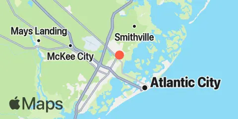
Latitude
39° 25' 24" N (39.4233)
Longitude
74° 30' 0" W (-74.5)
State
County
Nearest ZIP
08201
Nearby
Tides
3.0 mi
Pleasantville, Lakes Bay, Great Egg Harbor Inlet
4.8 mi
Absecon Channel, State Route 87 bridge
5.4 mi
Dock Thorofare, Risley Channel
6.2 mi
Ventnor City, Ocean Pier
6.4 mi
Atlantic City
7.3 mi
Main Marsh Thorofare
7.3 mi
Brigantine Channel @ Hoffman Thorofare
8.0 mi
Nacote Creek, U.S. Highway 9 bridge, Mullica River
8.0 mi
Steelmanville, Patcong Ck., 2.5 n.mi. above ent, Great Egg Harbor Bay
8.1 mi
Longport, Risely Channel
8.9 mi
Chestnut Neck Boatyard, Mullica River
10.1 mi
Graveling Point, Great Bay
10.8 mi
Seven Island, Newmans Thorofare, Great Bay
11.0 mi
Shooting Thorofare, Little Egg Inlet, Great Bay
11.6 mi
Beesleys Point, Great Egg Harbor Bay
11.8 mi
Little Sheepshead Creek, Great Bay
12.1 mi
New Gretna, Bass River, Mullica River
12.2 mi
River Bend Marina, Great Egg Harbor River
12.3 mi
Mays Landing, Great Egg Harbor River
Currents
5.6 mi
Absecon Inlet
