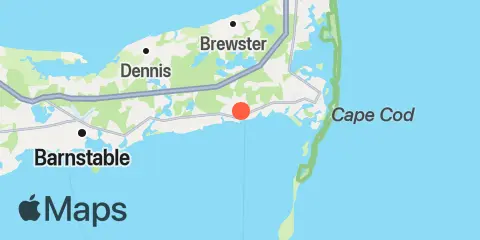
Latitude
41° 39' 54" N (41.665)
Longitude
70° 3' 54" W (-70.065)
State
County
Nearest ZIP
02646
Nearby
Tides
0.5 mi
Saquatucket Harbor, Nantucket Sound
2.6 mi
Dennisport, Nantucket Sound
5.1 mi
Chatham, Stage Harbor, Cape Cod
6.1 mi
Chatham, Cape Cod
6.1 mi
South Yarmouth, Bass River, Nantucket Sound
6.6 mi
Pleasant Bay, Cape Cod
7.6 mi
Sesuit Harbor, East Dennis, Cape Cod Bay
12.0 mi
Barnstable Harbor, Beach Point, Cape Cod Bay
12.4 mi
Hyannis Port, Nantucket Sound
Currents
4.2 mi
Dennis Port, 2.2 miles south of
4.7 mi
Stage Harbor, west of Morris Island
8.3 mi
Monomoy Pt., channel 0.2 mile west of
8.6 mi
Monomoy Point, 6 miles west of
9.0 mi
Pollock Rip Channel (Butler Hole)
10.1 mi
Pollock Rip Channel, east end
11.0 mi
Lewis Bay entrance channel
11.2 mi
Point Gammon, 1.2 miles south of
11.6 mi
Barnstable Harbor
12.2 mi
Handkerchief Lighted Whistle Buoy 'H'
